 Butler County - home |
|
||||||
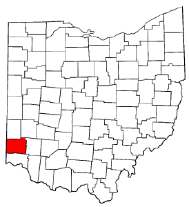
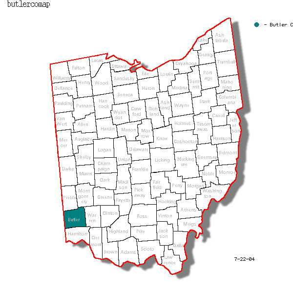
Browsing Butler County Ohio
Butler County Ohio Wall Map

|
 Ohio Maps OnLine: * Counties maps of OH |
Digital Ohio maps |
ODOT Maps Resource Page Ohio Maps OnLine: * Counties maps of OH |
Digital Ohio maps |
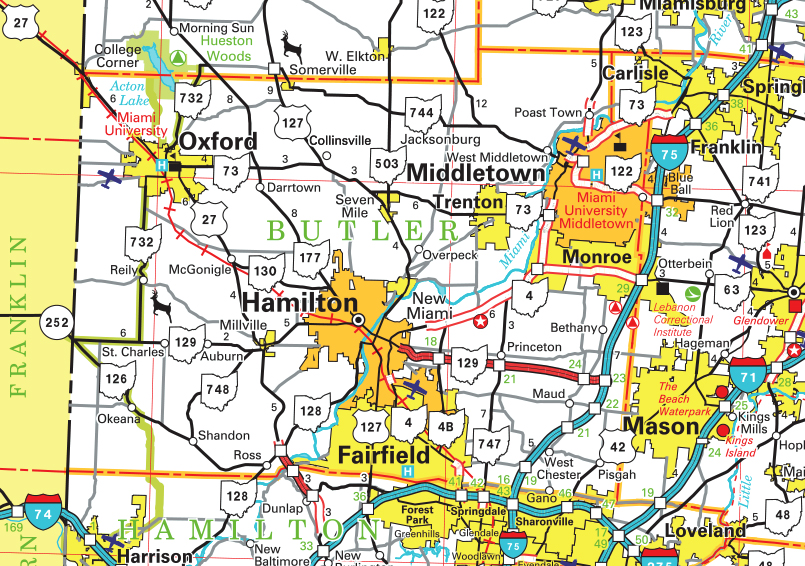
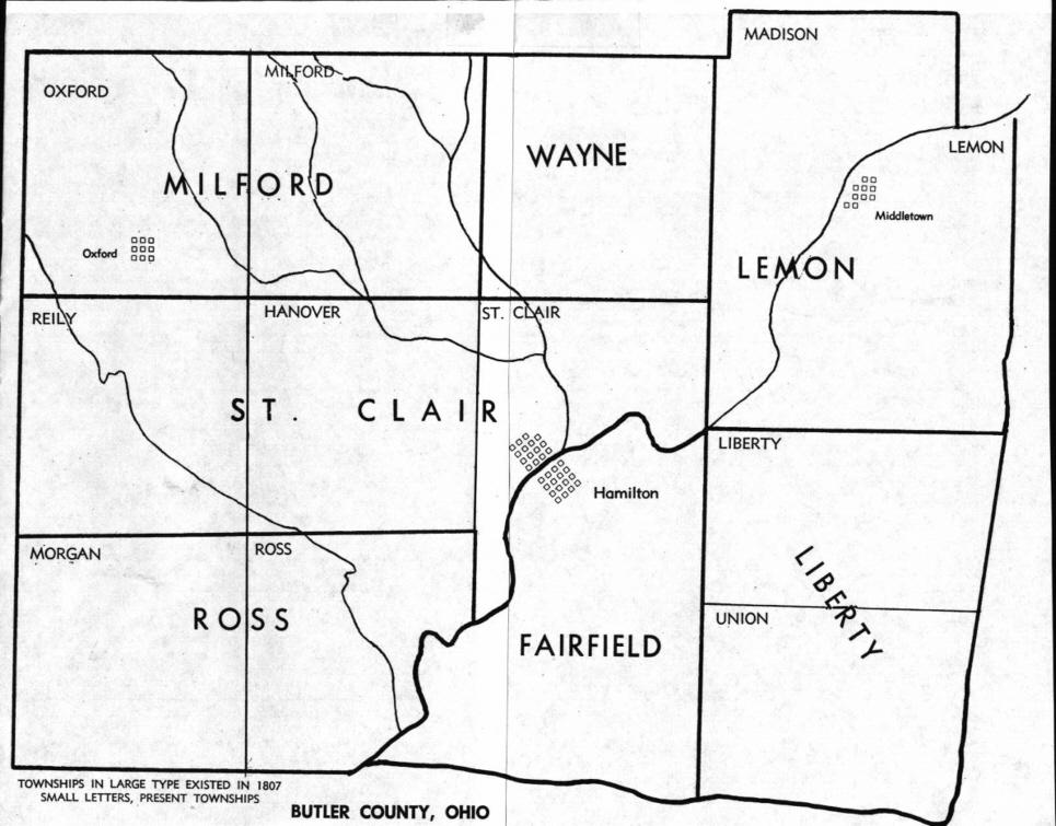
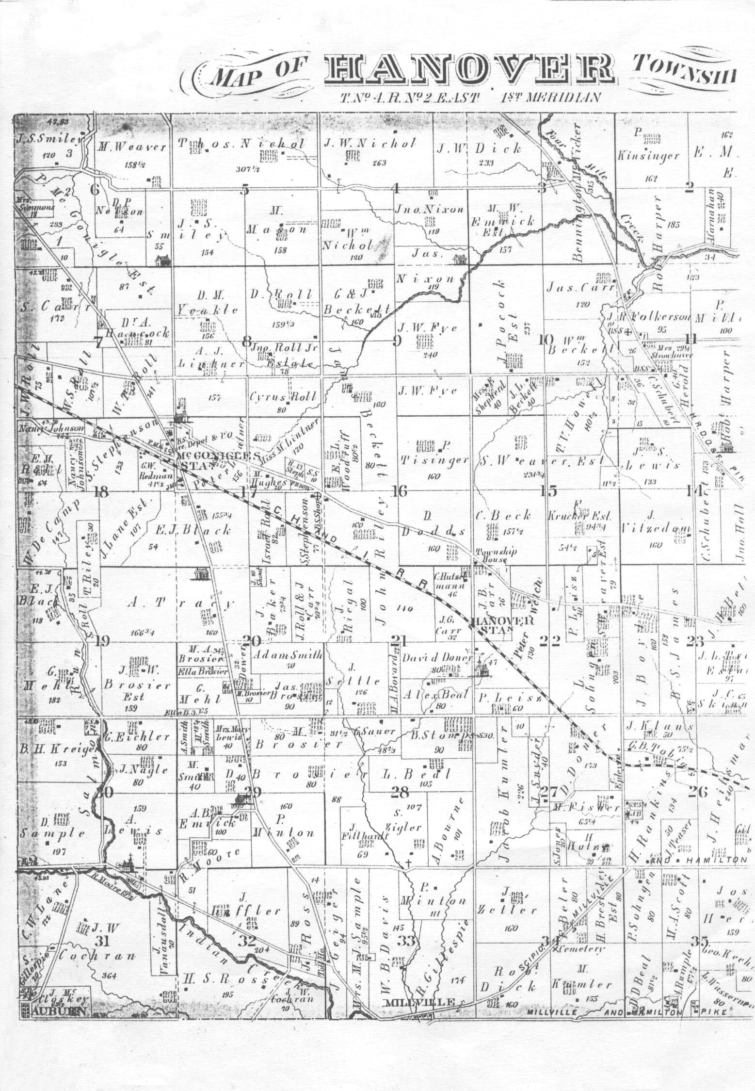
ODOT Maps Resource PageOhio: * Formation of the state of Ohio, timeline maps * On-line Map searches, Google Other Historic Maps Local Butler County CURRENT Maps OnLine: ODOT map* Butler Co GIS Map Gallary index, including current Land Cover map, pdf file * Butler Co Engineer's Office Highway map and OnLine Map, with street index search * Topography and Archaeology of Butler Co OH * Topography map, from Morgan twp * Topographical atlas of Ohio. (Butler Co) David Rumsey Map Collection * MapQuest * Google interactive map * OhioLine Butler County TOWNSHIP Maps: * Old (1807 - smaller) and current township names & facts (WestChester replaced Union, 2000) * McBride's 1834 Reappraisal Maps: PDF files from Records Center and Archives of Butler County Ohio * McBride's 1836 Maps and name search: (contributed by D. Kowallek and B. McMaken, 2006) * 1875 townships, sections, ranges * Hanover twp plat map, 1875 (click to enlarge) * 1895 Butler Co * 1914 Butler & Hamilton Cos * Current OnLine Map: click on townships for section numbers Butler County FEATURE maps:* Local covered bridges * Bicentennial Barn map, 2003 * County Parks * Fishing Prospects * Glacial Deposits map * Quaker meeting map 1851-53 * 1915 Railroad map, southern Ohio Search Butler County features: Geographic Names Information System (GNIS) USGS query form
Butler County, Ohio Places compiled by Larry Helton 1993:Many of these places still exist. Those that do not often have a nearby road, school, or business named after the place now gone. I can tell you where most of these places were or is located and possibly where the name came from, others I can give you my guess. *Most common name followed by other known names if applicable.Enjoy, Larry
Athlone Amanda - Amanda Station Astoria - Jacktown Auburn - Gandertown, Selkirk Alert - Alert Station Bethany Boogerville Bruce's Station Ball's Ferry - Brownstown Bunker Hill - Dogtown Blue Ball - Guilford Busenbark - Busenbark's, Busenbark Station Campbell's Station Charley Town Christiana Clinton Contreras Crescentville City View Heights - High Bank College Corner - College Corners Darrtown Debbysville Daraugh's Station - Darraugh,Derrah,Dorrough,Dorough,Deuron Dick's Mill - Dick's Crossing Doty - Doty Settlement Eighteen Mile Stand East Hamilton Edgewood Excello - Engle's Corner,Morrell's Station Fairfield Flenner's Corner Fairplay - Fair Play,Alston's Mill,Graham's Mill,Black Bottom,Hart's Block Flockton - Flocton Fairsmith - Smith's Station Gano Georgetown Gregory's Station Hamilton Hanover Station Huntsville Hughe's - Hughe's Station Indian Springs Isis Inxworth Jefferson Jacksonburg - Jacksonburgh,Jacksonboro,Jacksonborough Jericho - Jerico,Jerico Corners Kyle - Kyle's.Kyle's Station,Fontana Lamberton Lay High Lemon Lindenwald LeSourdsville - Freeman's Station,Freemansburg,Knorr Maustown Mount Auburn Monroe Station Manchester McDonald Middletown Monroe Millville Miltonville Minktown Macedonia McGonigle - McGonigle Station Morgantown - Whitewater, Whitewater Shaker Village Mulhauser - Mulhauser Station Maud - Maud's,Maudville,Shoemaker,Maud Station Mosler - Mosler's Newkirk New Miami - Coke Otto,Otto,Kokotto Oxford Oneida Oak Hill Oakland - Oakland Station Okeana - Tariff Overpeck - Overpeck's Station Ogleton - Ogleton Station Pisgah Poasttown Heights Peck's Addition Poasttown - Poast Town,Post Town,Poasttown Station,West Liberty Port Union - McMaken's Bridge Peoria - Ingleside Princeton - Clawson,Clawson P.O. Rossville Rockdale Rialto Reily - Reiley Richville - Amanda Ross - Venice,Venus Reed's Station - Reed's Station Center South Hamilton Crossing Sunbury Shelley Station St.Charles - Saint Charles Schenck's - Schenck's Station Shandon - Cambria,Paddy's Run,New London,Vaughn,Glendower,Shandon Station Seven Mile - 7 Mile,Utica South Hamiklton - Sloptown Somerville - William's Store Stillwell's - Stillwell's Corner Symme's Corner - Symme's.Symme's Corners,Symme's City,Union Corners Scipio - Philantropy,Philanthropy Stockton - Jones',Jones' Station Snaptown - Surmandale,Snopstown,Schnapstown,Schnaps Town,Snagtown Templetown Tylersville - Pug Muncy Trenton - Bloomfield Williamsdale Winton Wood's - Wood's Station, Rogersville West Middletown - Heno,Madison City Woodsdale - Augspurger West Chester - Chester,Mechanicsburg,Westchester West Chester Station - Chester Station | ||||||||||||||||||||||||||


 map
map
This page was moved to Rootsweb.com on March 7 1997
as part of the Butler County OHGenWeb Project Page.
(N. Sween)
Free People Search