|
Robert Daniel
Plat map  On this map you can see the
pencil marks on the left, that mark the Daniel
Family Lands.
Of course the R Daniels is Robert Daniel, this map was published in 1908. He is noted as an owner at one time. And you see Herbert Daniel there too. The red lines are the school district lines. The names are the larger words. Overton School District no, 103 was above Robert Daniels Land, and the Martin Springs School Dist no.100, was his homes' school district. 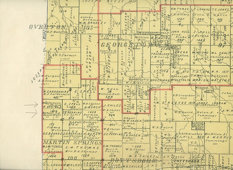
This is a plat from the 1908 plat map. Biography Index Susan Hawkins © 2025 If you find any of Grayson County TXGenWeb links inoperable, please send me a message. |