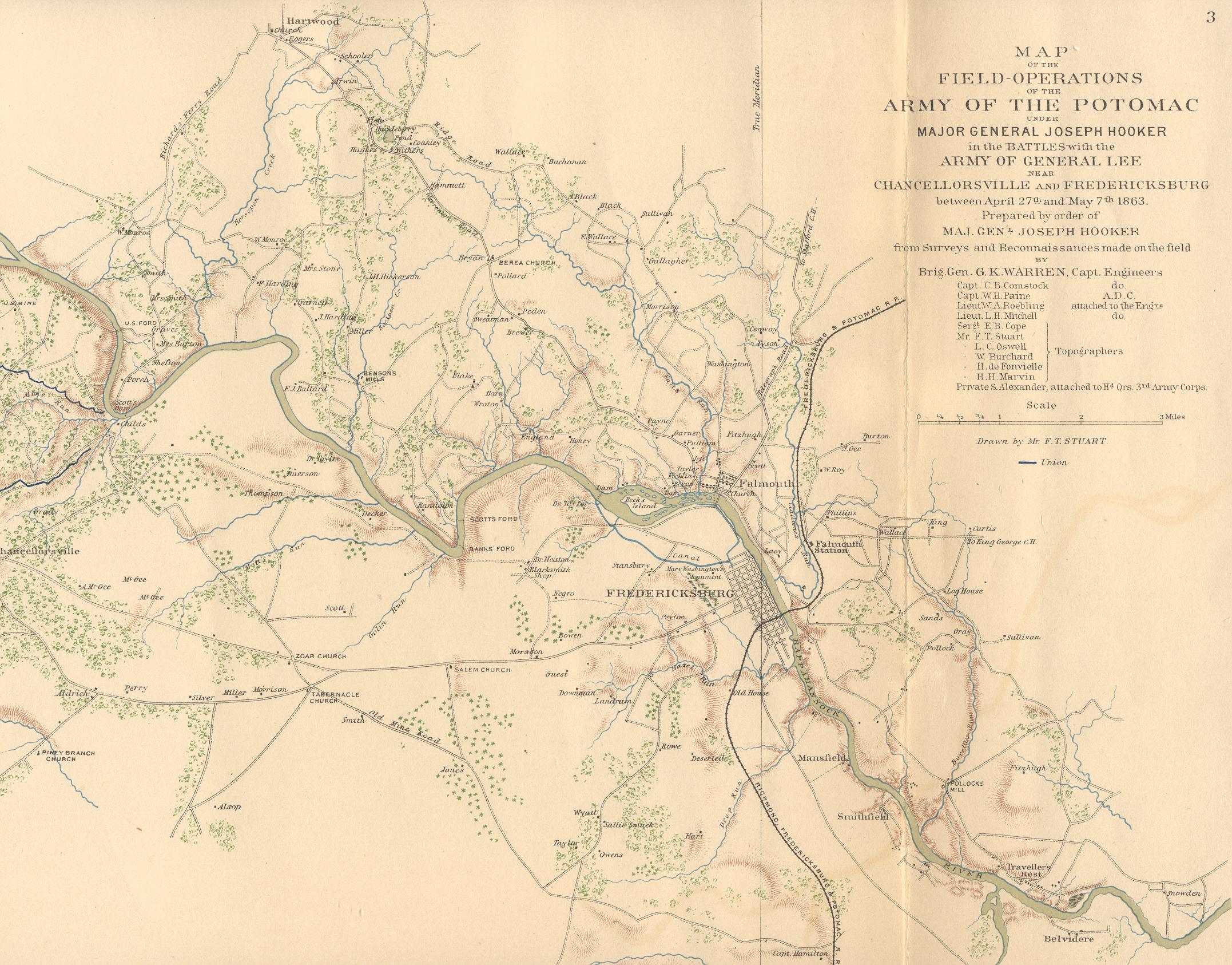
Civil War Map of Stafford County, Virginia
Submitted By: Sarah Reveley
This map was found in an Atlas dating to the late 1800s. The Atlas to Accompany the Official Records of the Union and Confederate Armies contains 175 pages (Plates) each 18 x 30 inches in size. Most of the plates contain maps, anywhere from one to 40 on a page, while some contain sepia-toned reproductions of old photographs and others are collections of line drawings of fortifications, weapons and logistical equipment. Two are full-color representations of uniforms and flags and insignia of both armies. Approximately 10,000 sets of the Atlas were produced between 1891 and 1895. Additional copies were printed for members of congress and other officials. Subscribers received the Atlas in installments (volumes) in the form of folders which usually contained five plates. After all 35 volumes were received most owners (usually libraries and institutions) had them bound together for ease of use. Estimates vary as to how many sets of the Atlas have survived, bound and unbound. Publication of the Atlas was funded by the U.S. Government with little regard to expense. The best lithographers and methods of the era (which in many ways are superior to today's) were used. Large groups of Army engineers were sent out on lengthy expeditions to create maps on a scale and with a level of detail economically unfeasible to any sane private enterprise.