Robinson's Atlas Maps
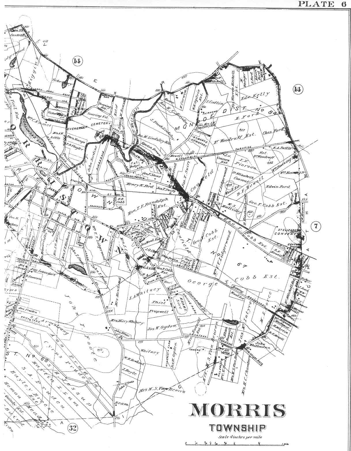
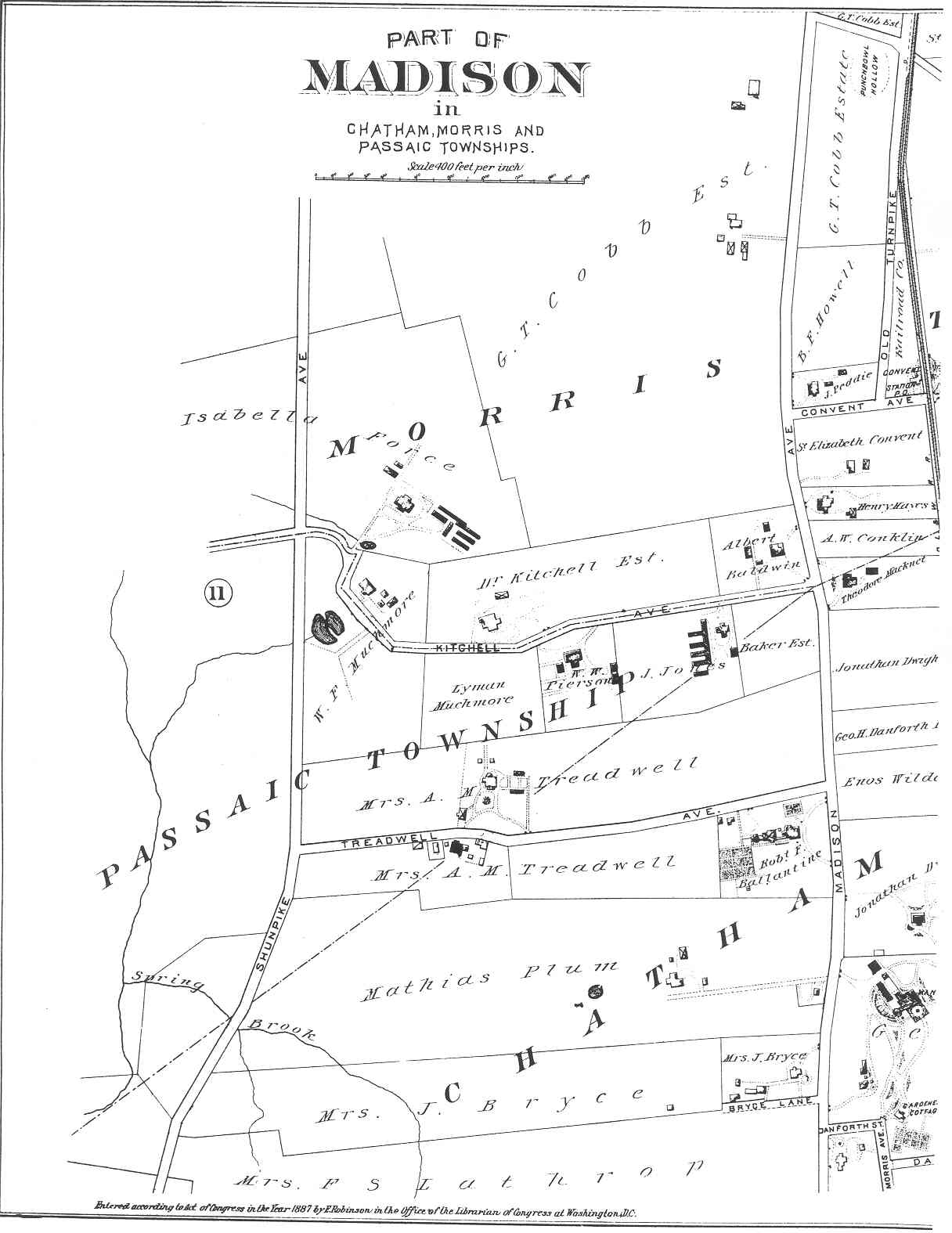
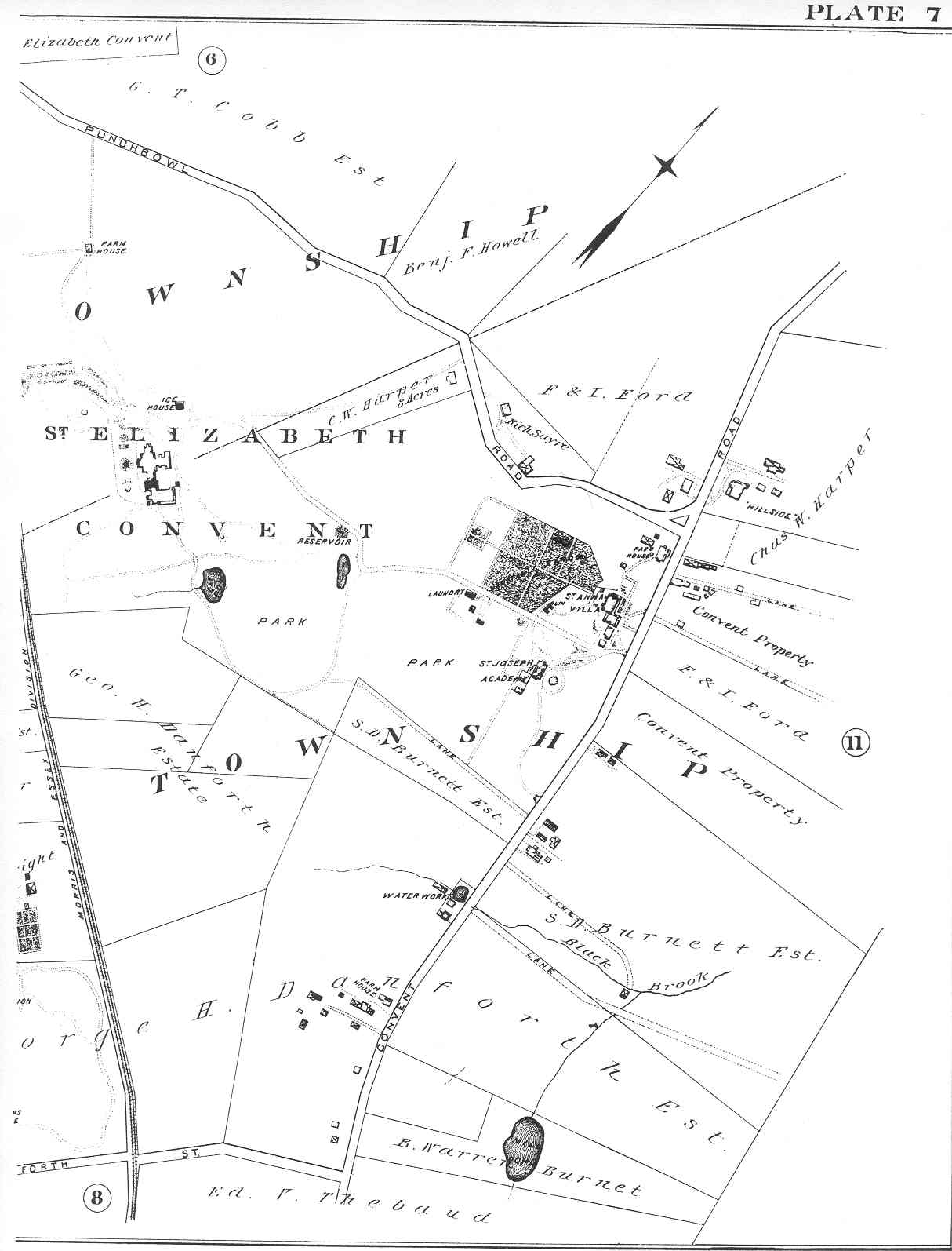
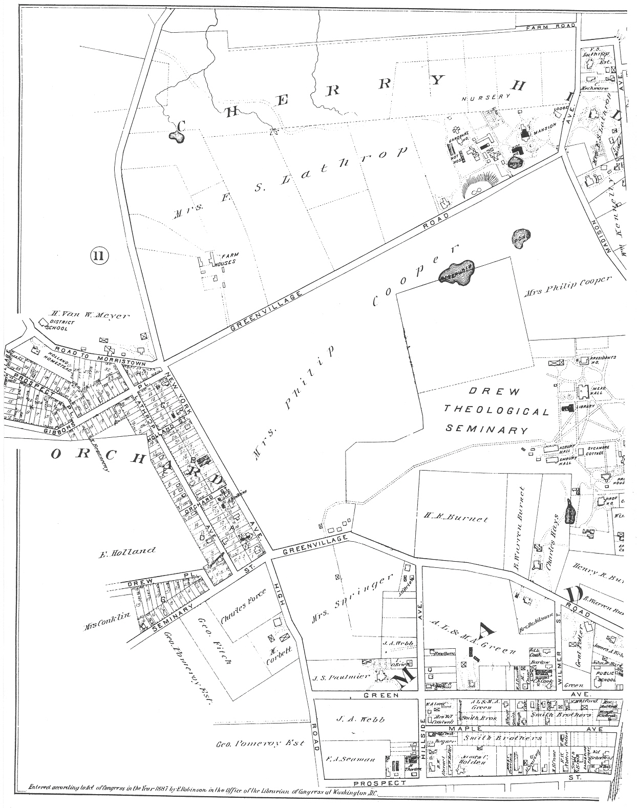
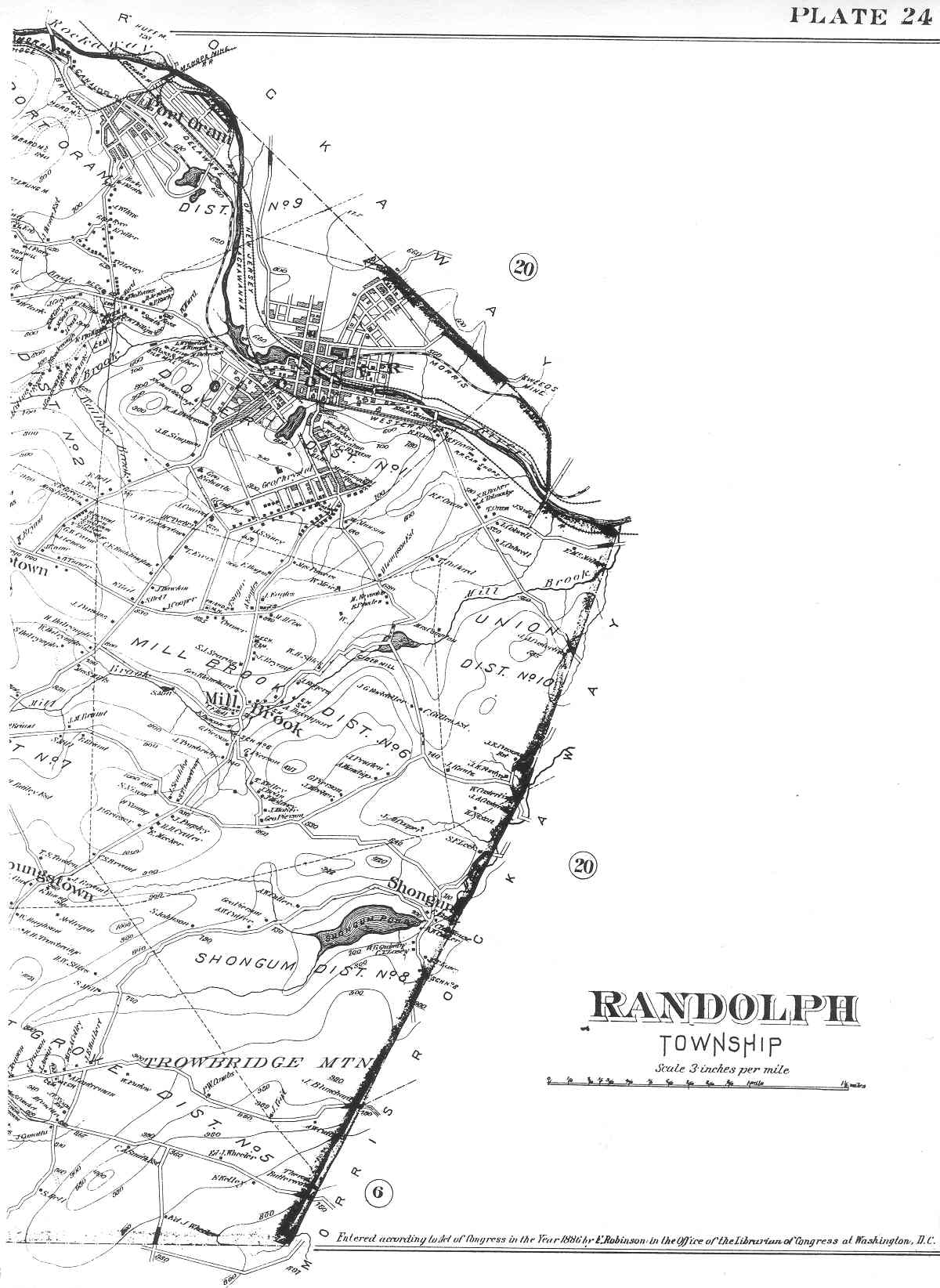
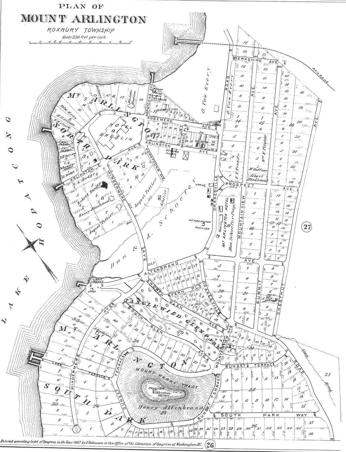
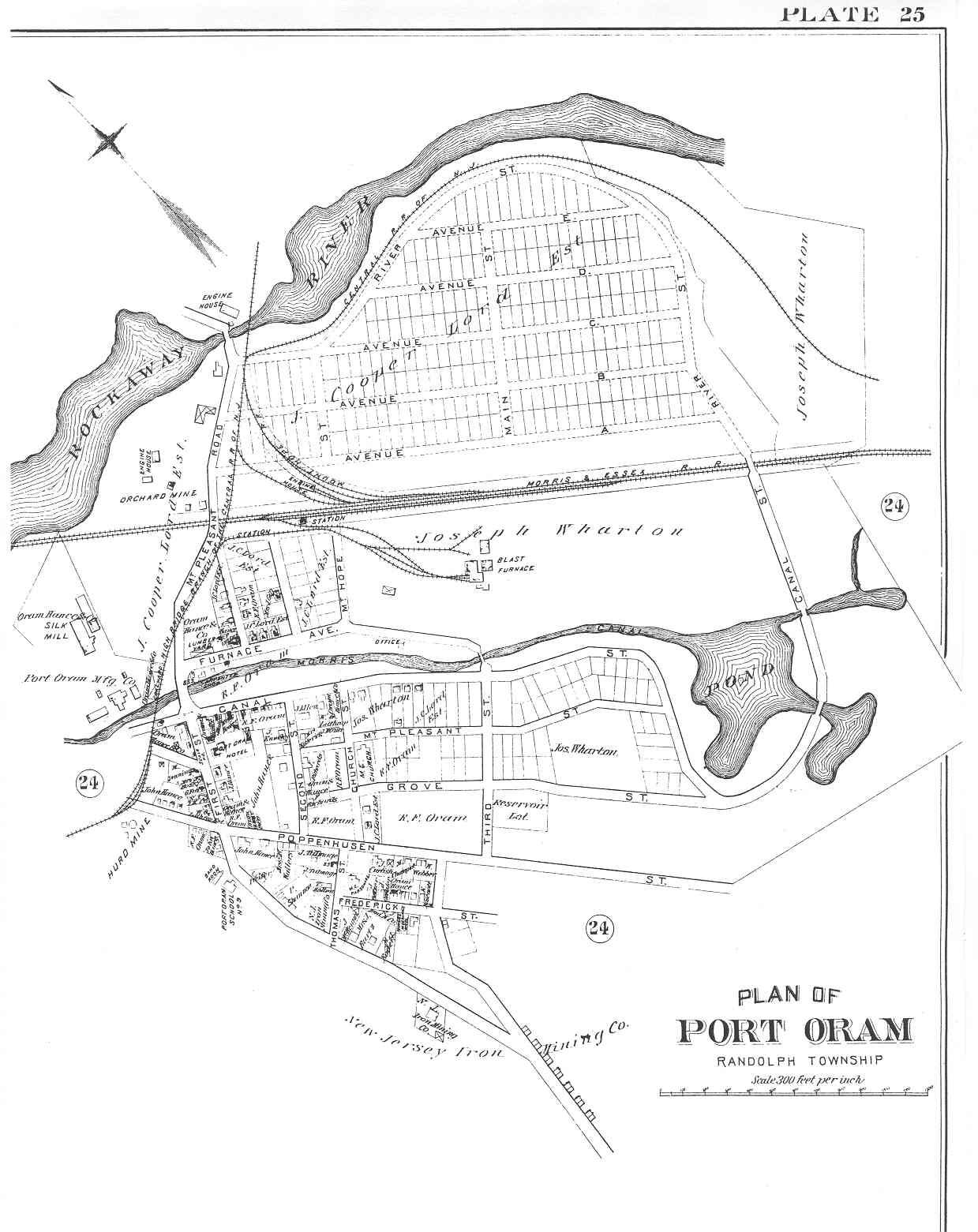
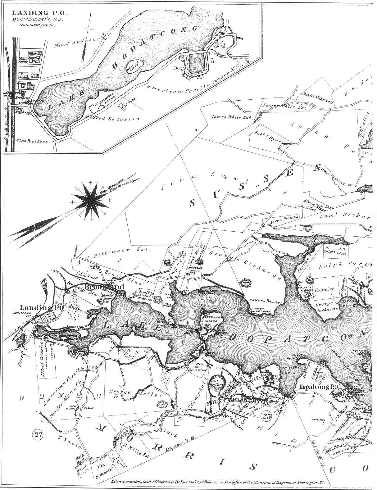
Morris County, New Jersey

Morris Co. Up


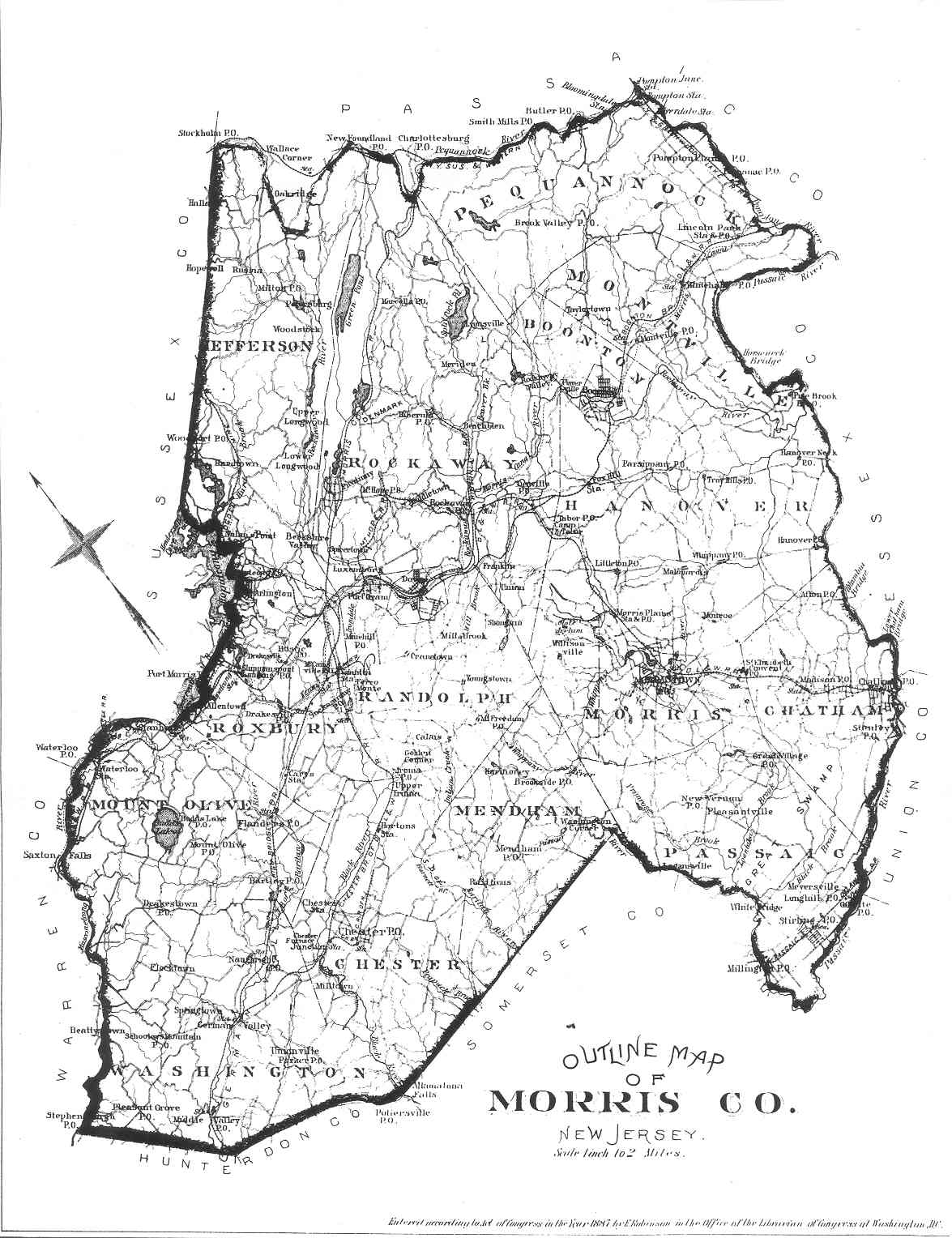
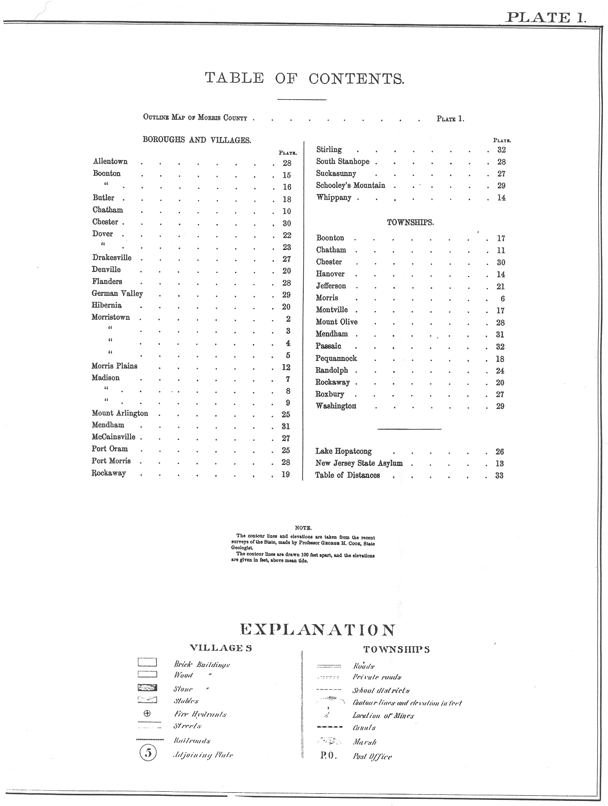
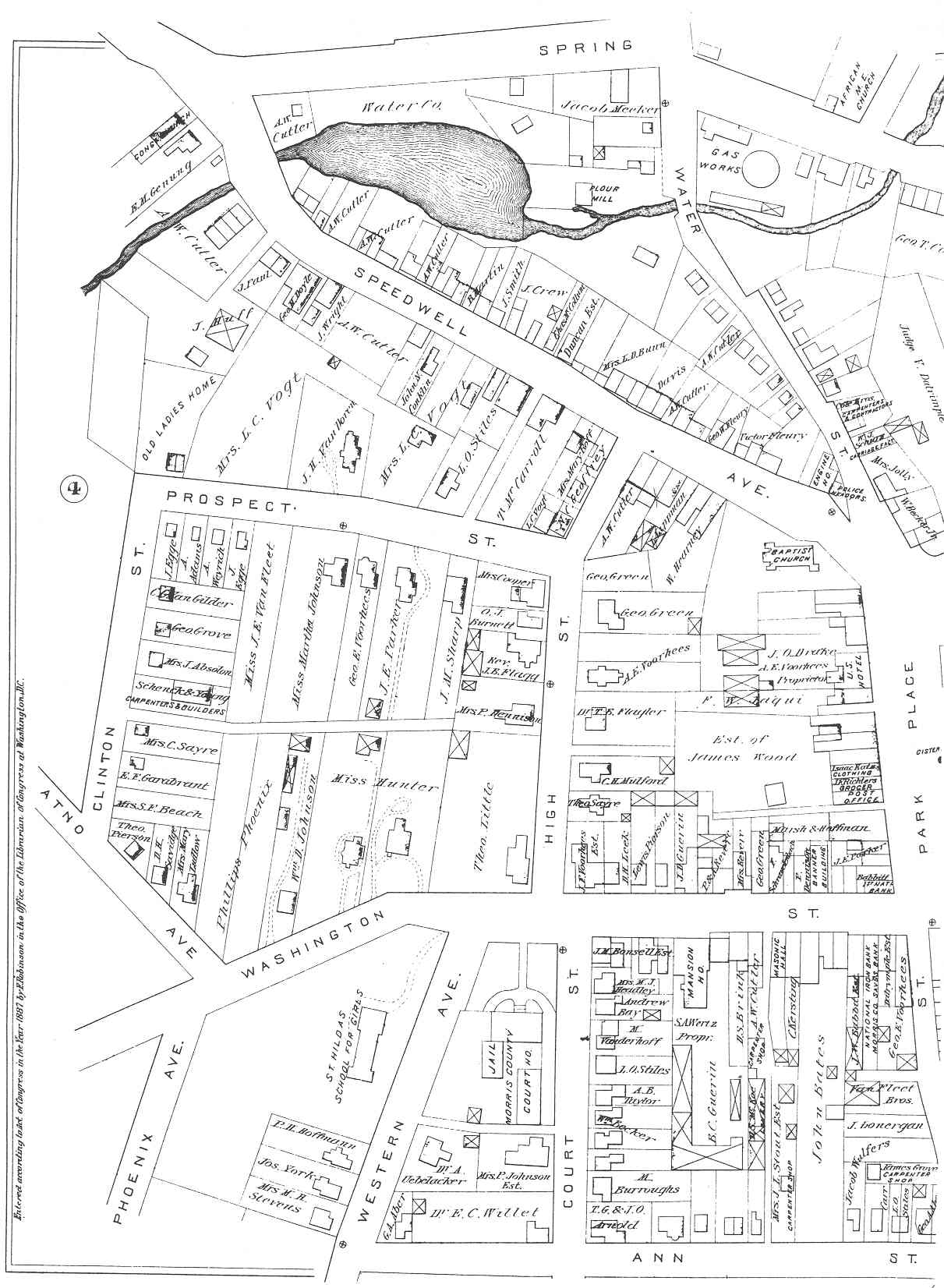
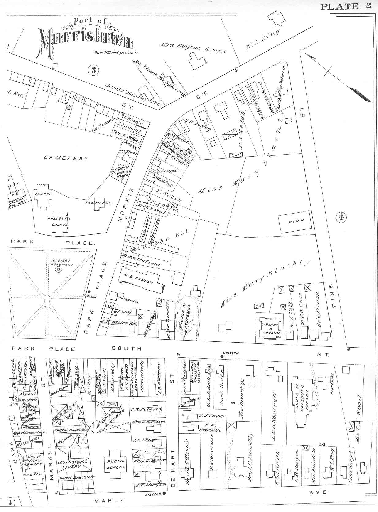
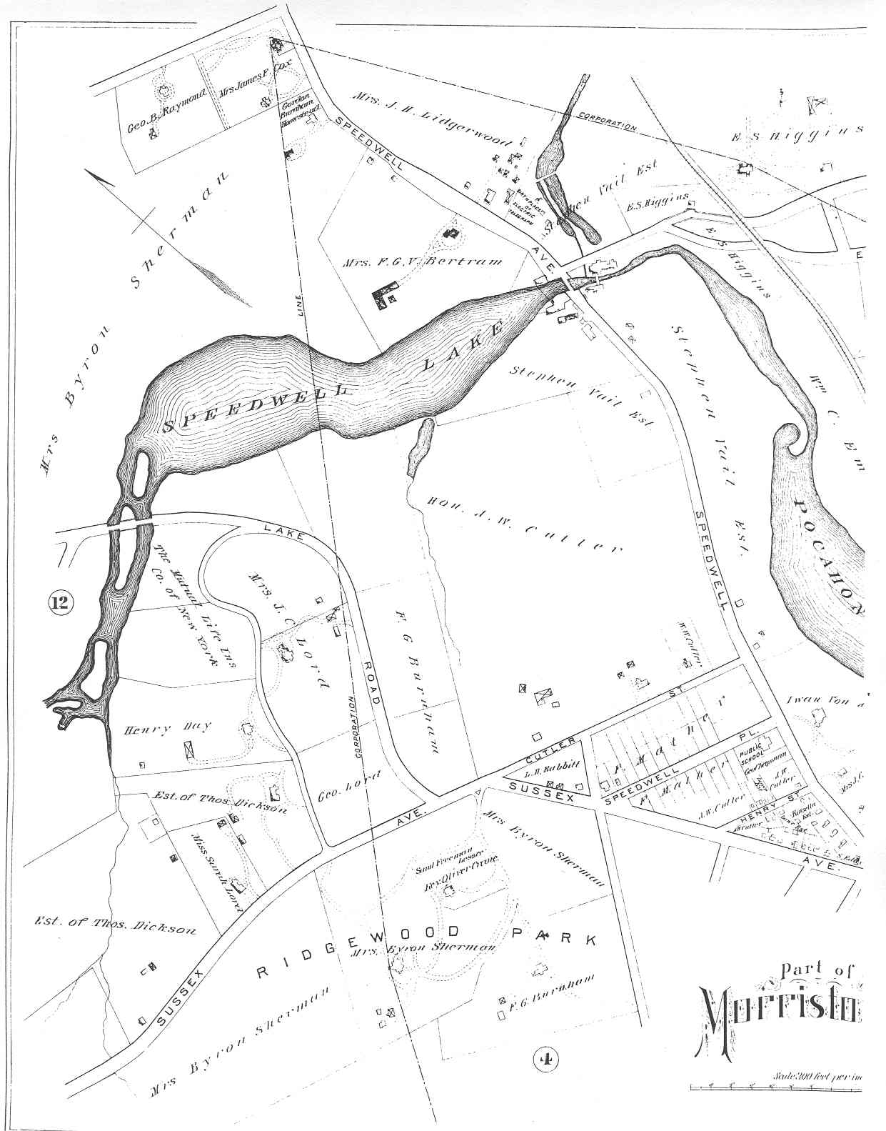
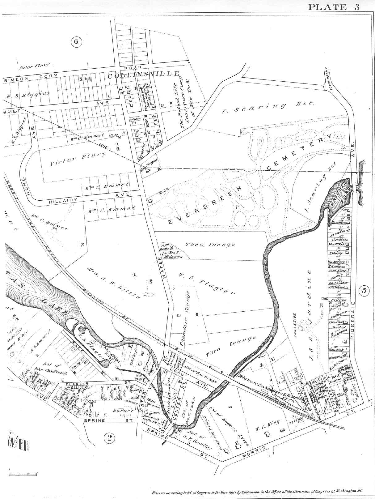
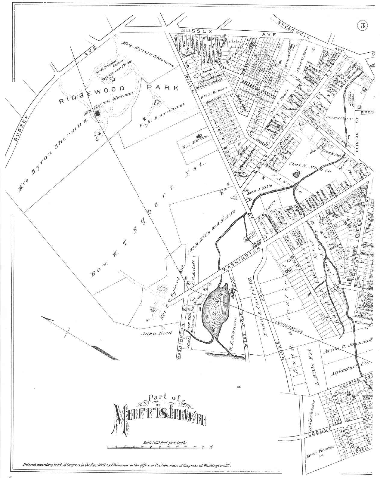
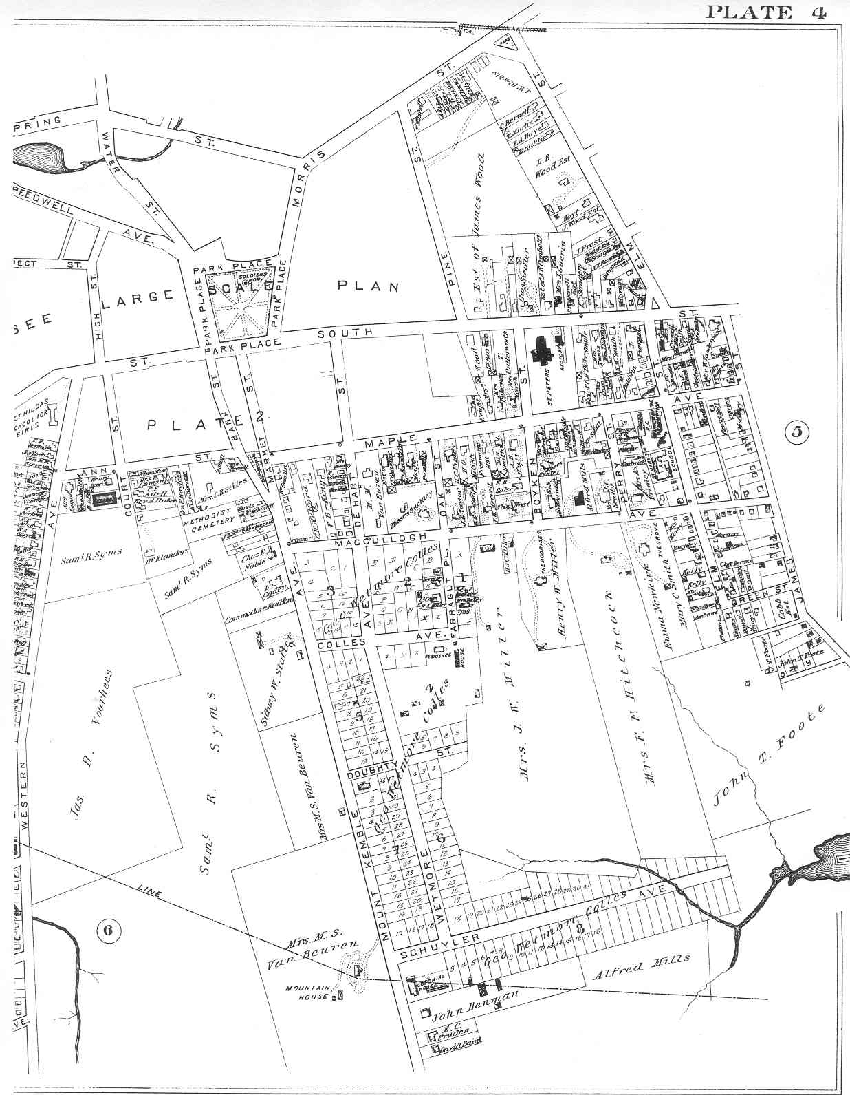
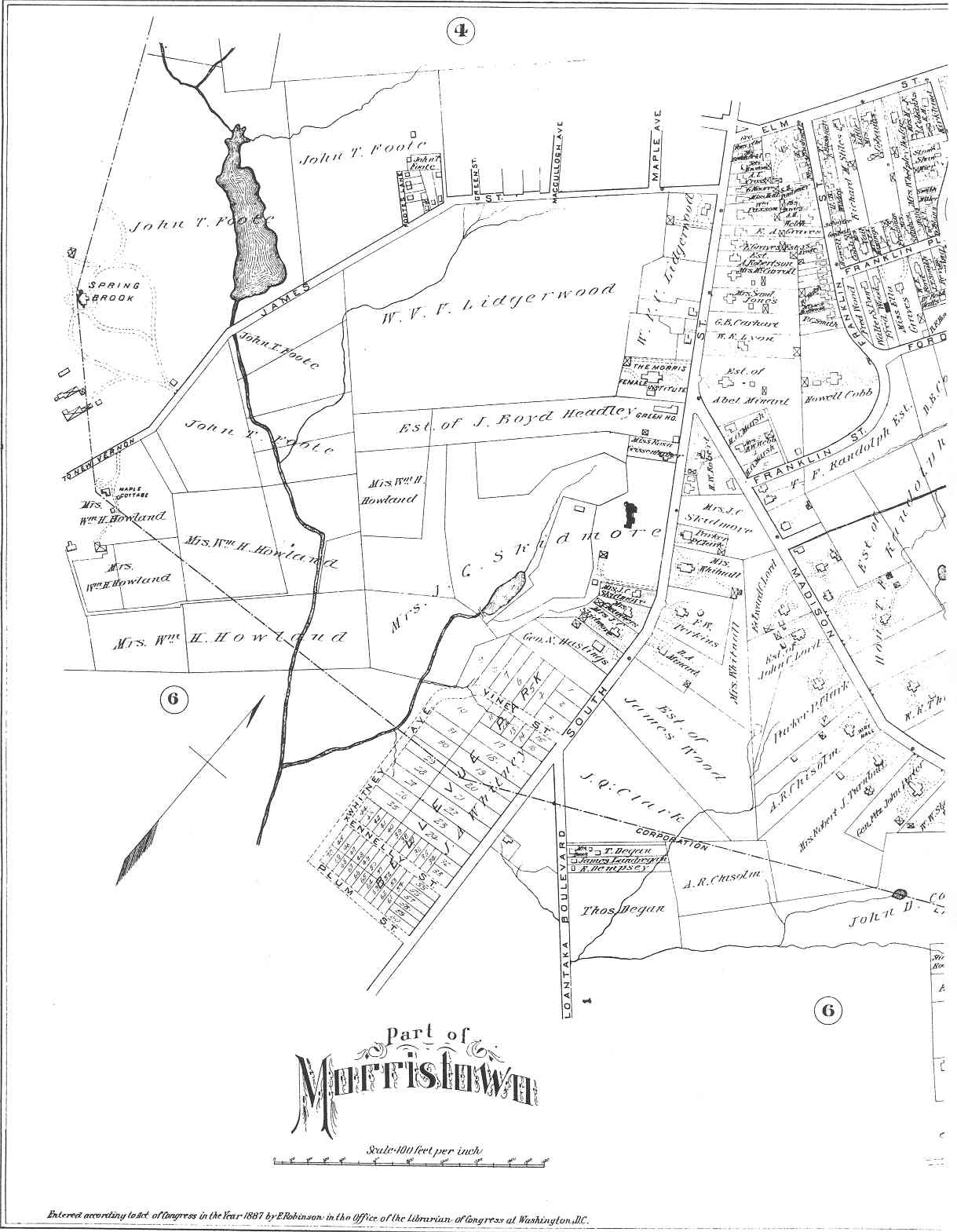
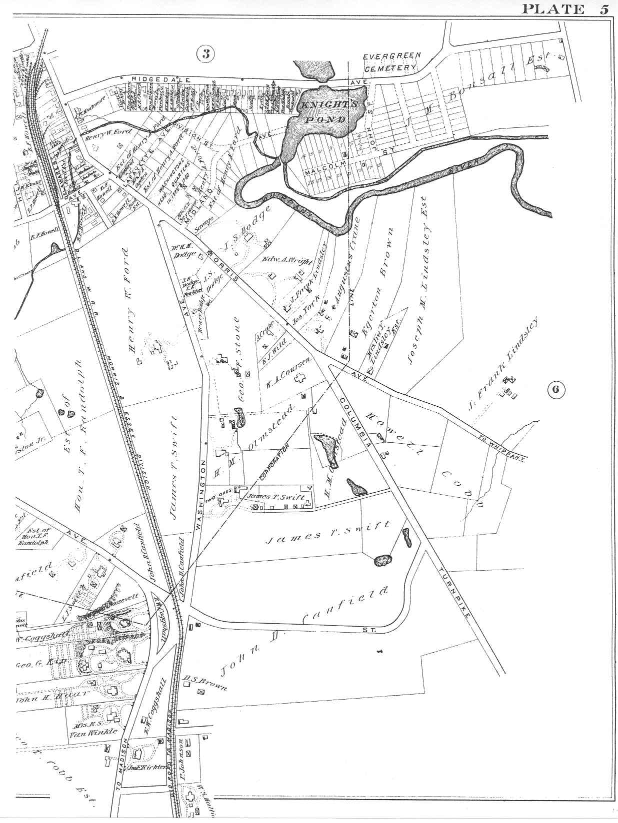
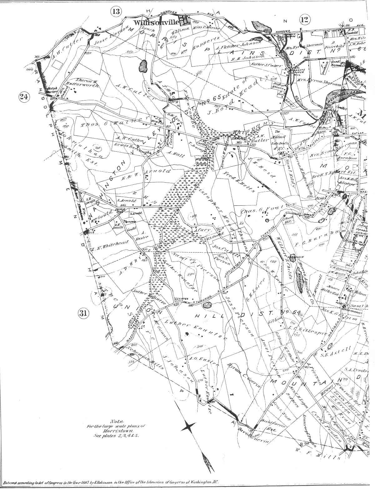
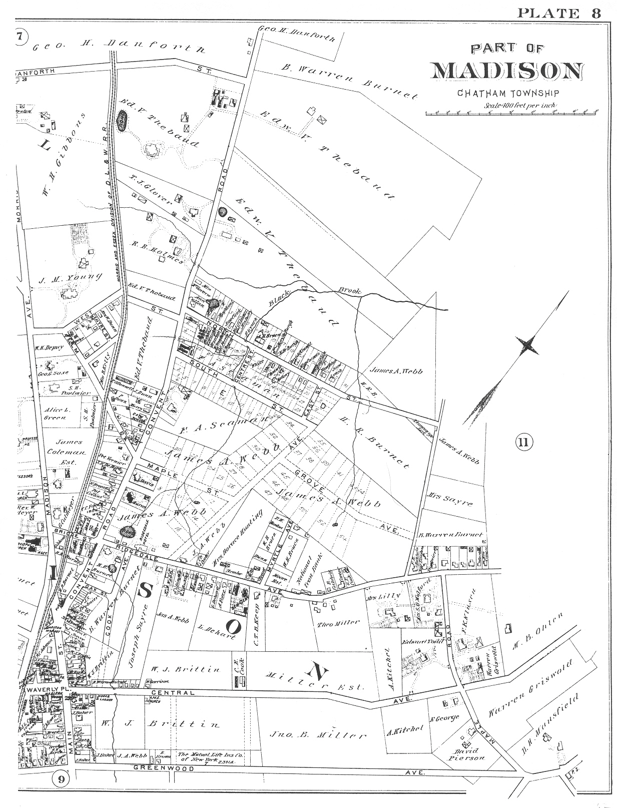
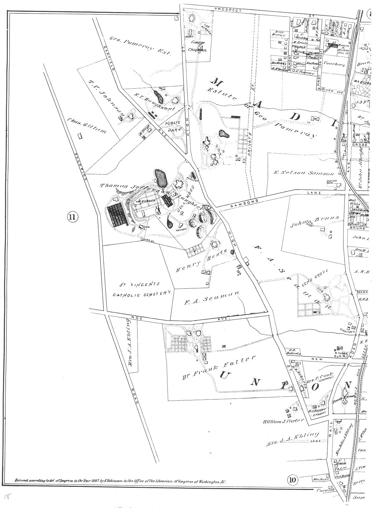
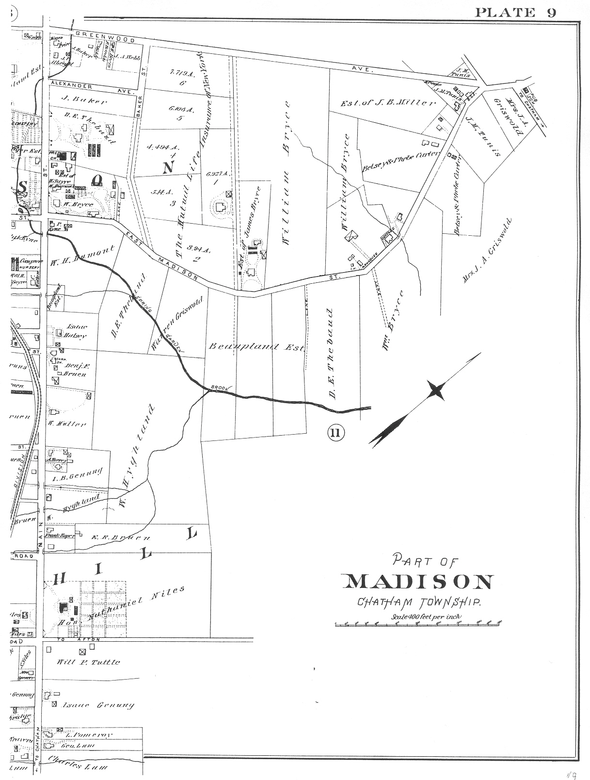
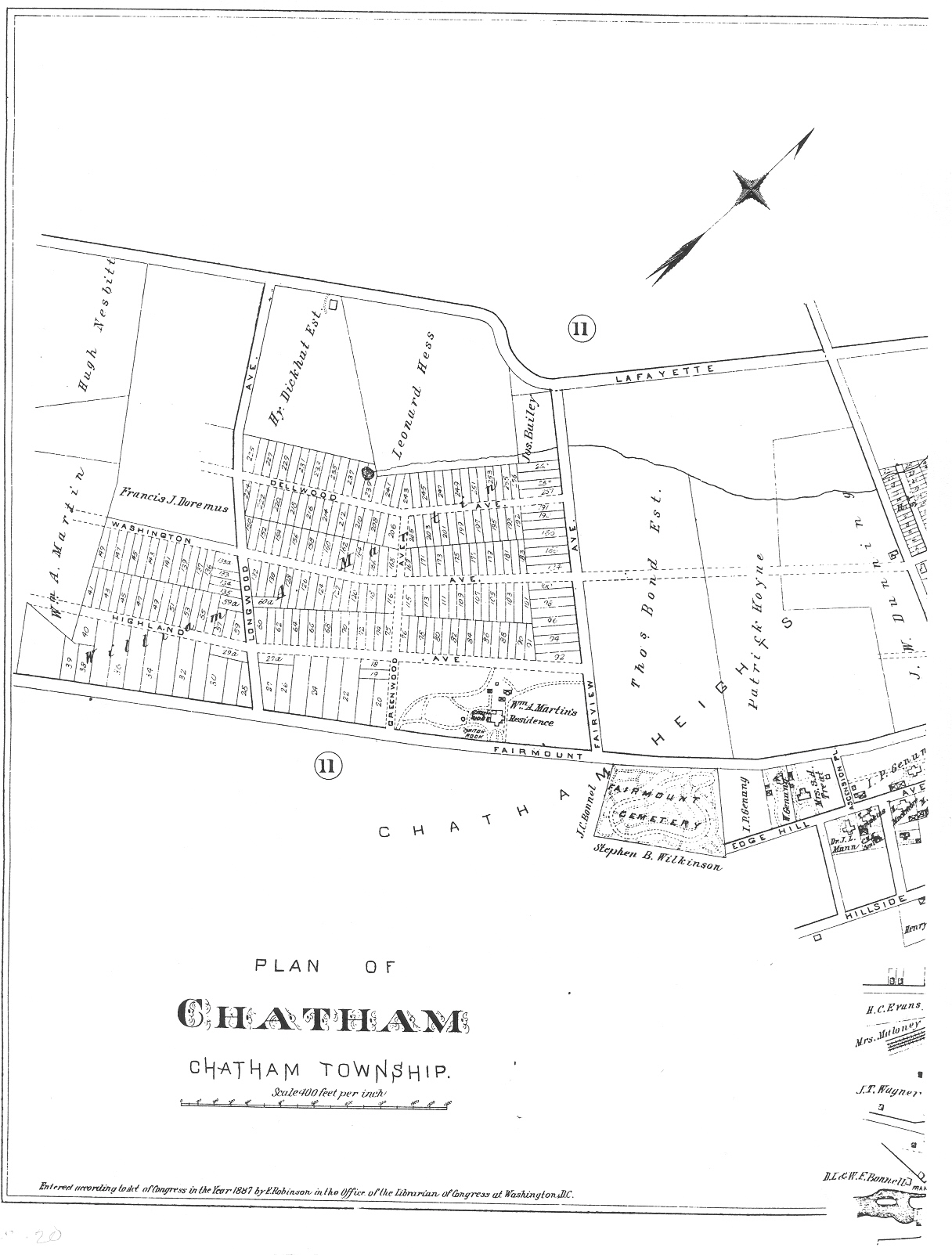
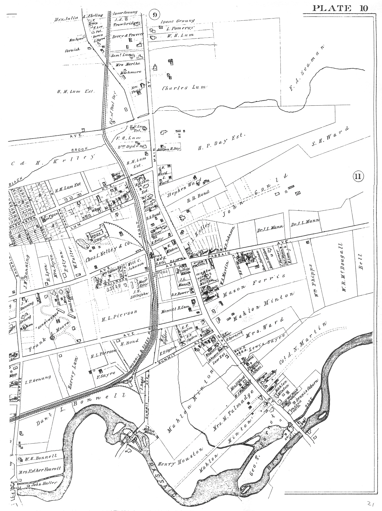
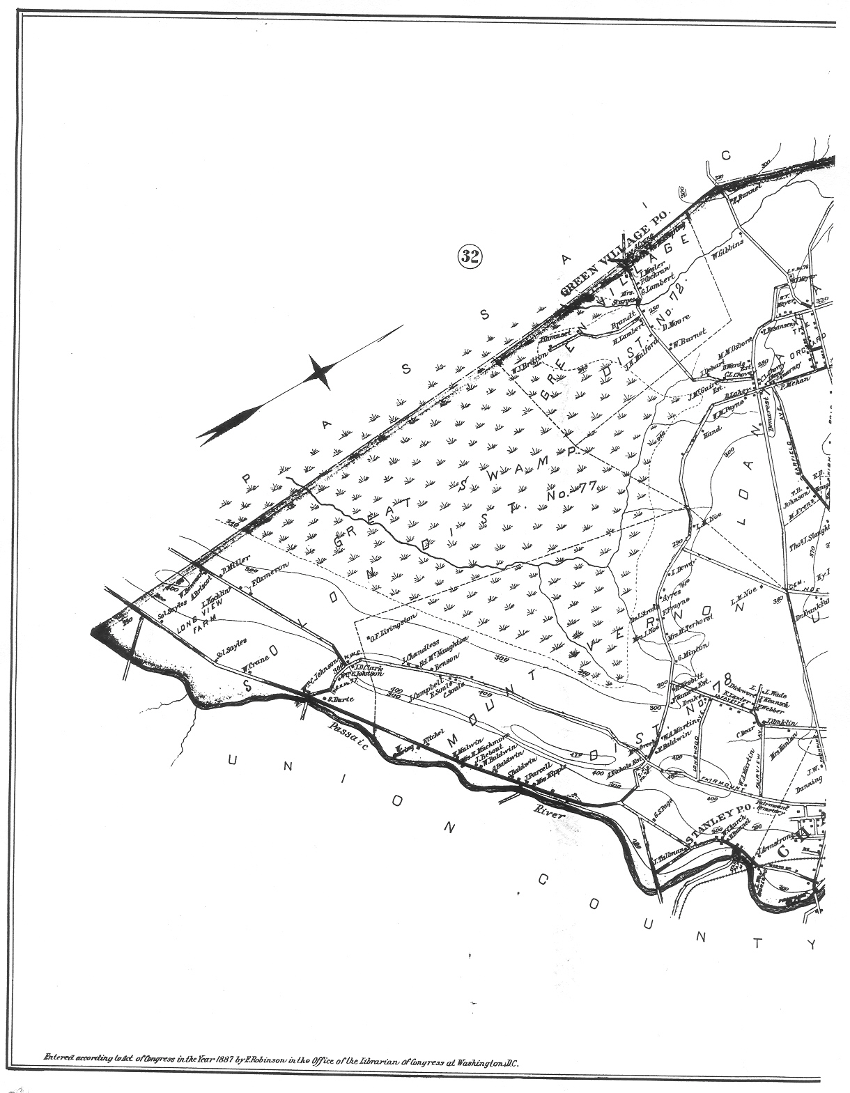
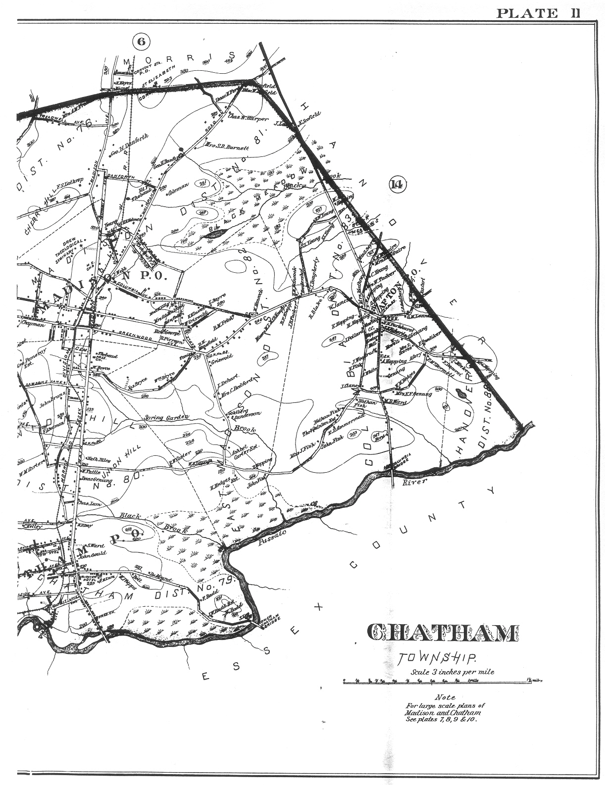
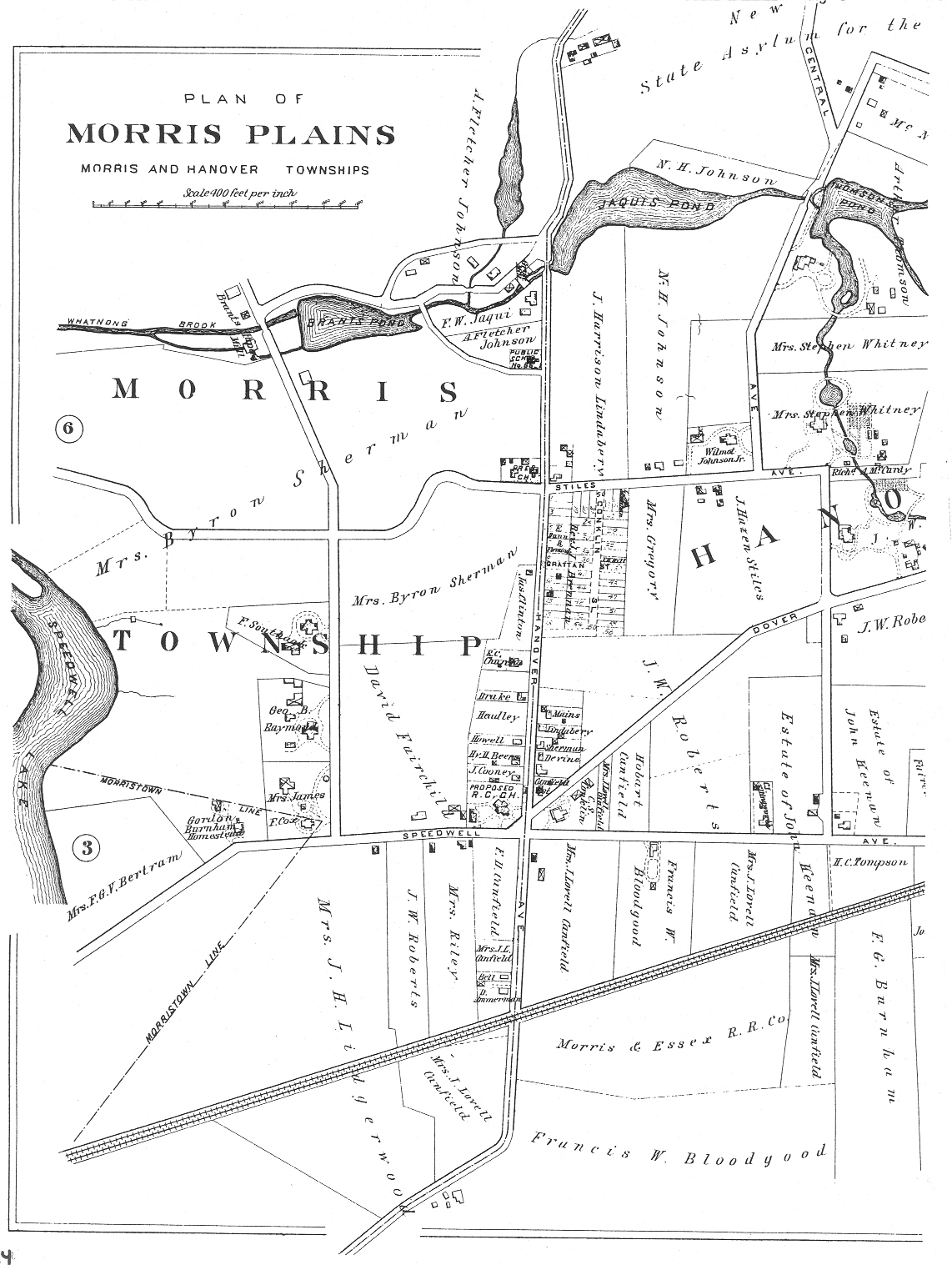
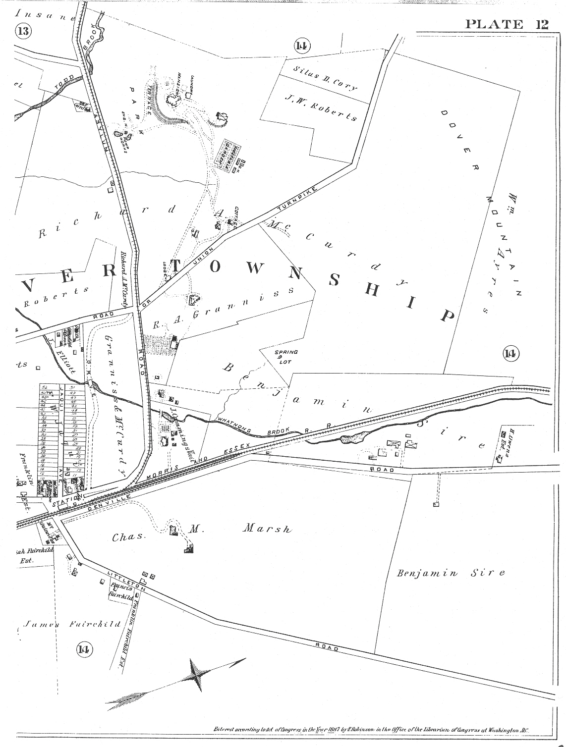
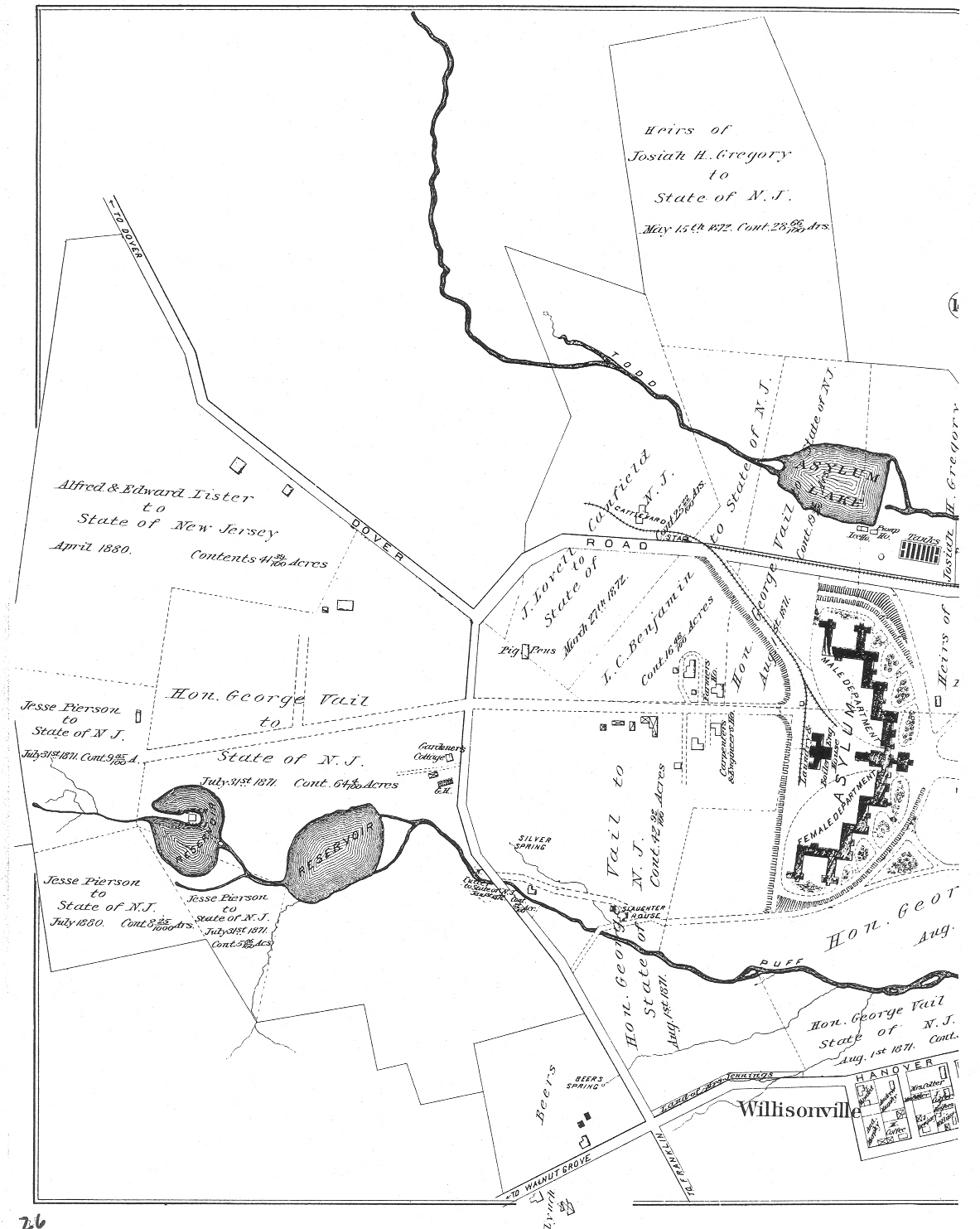
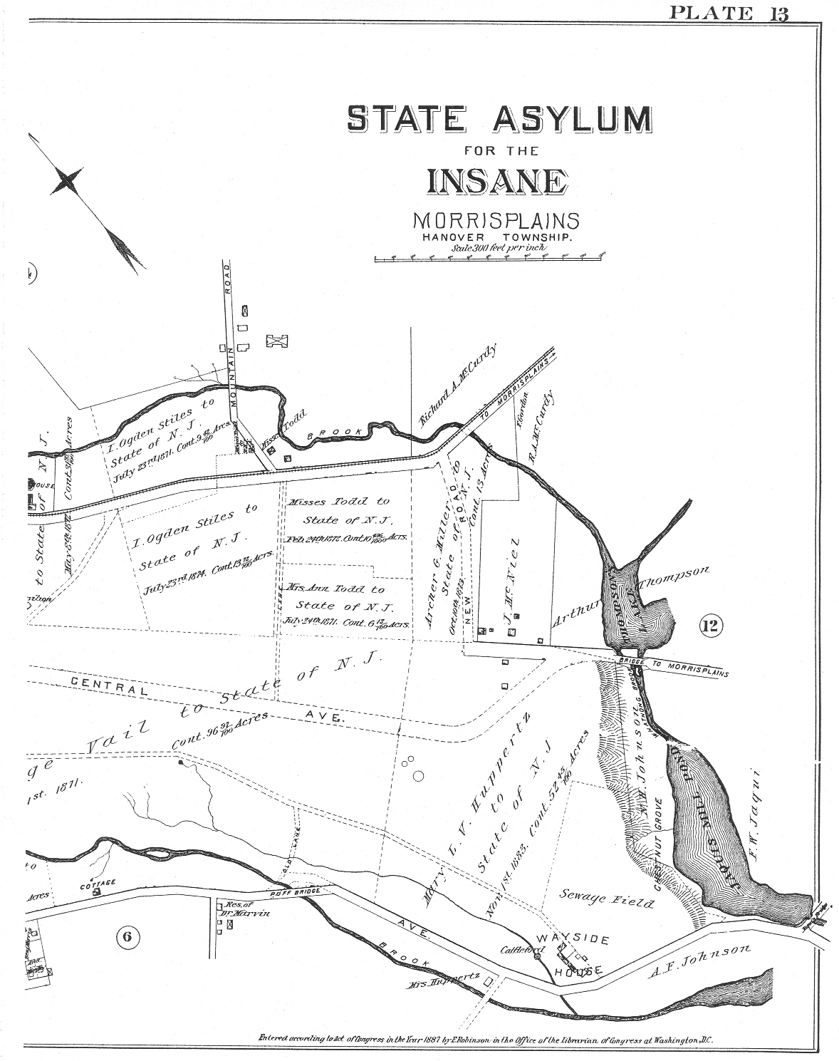
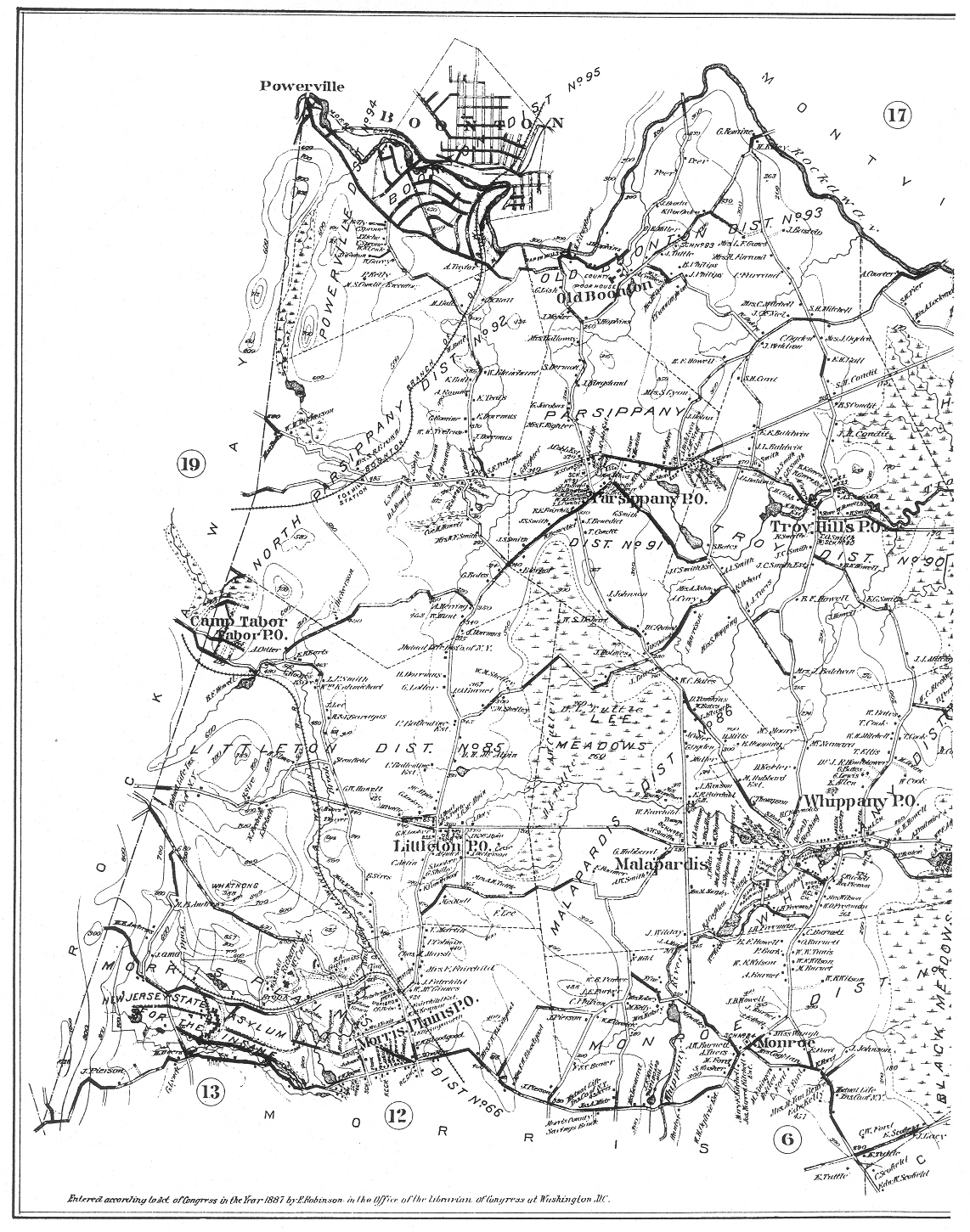
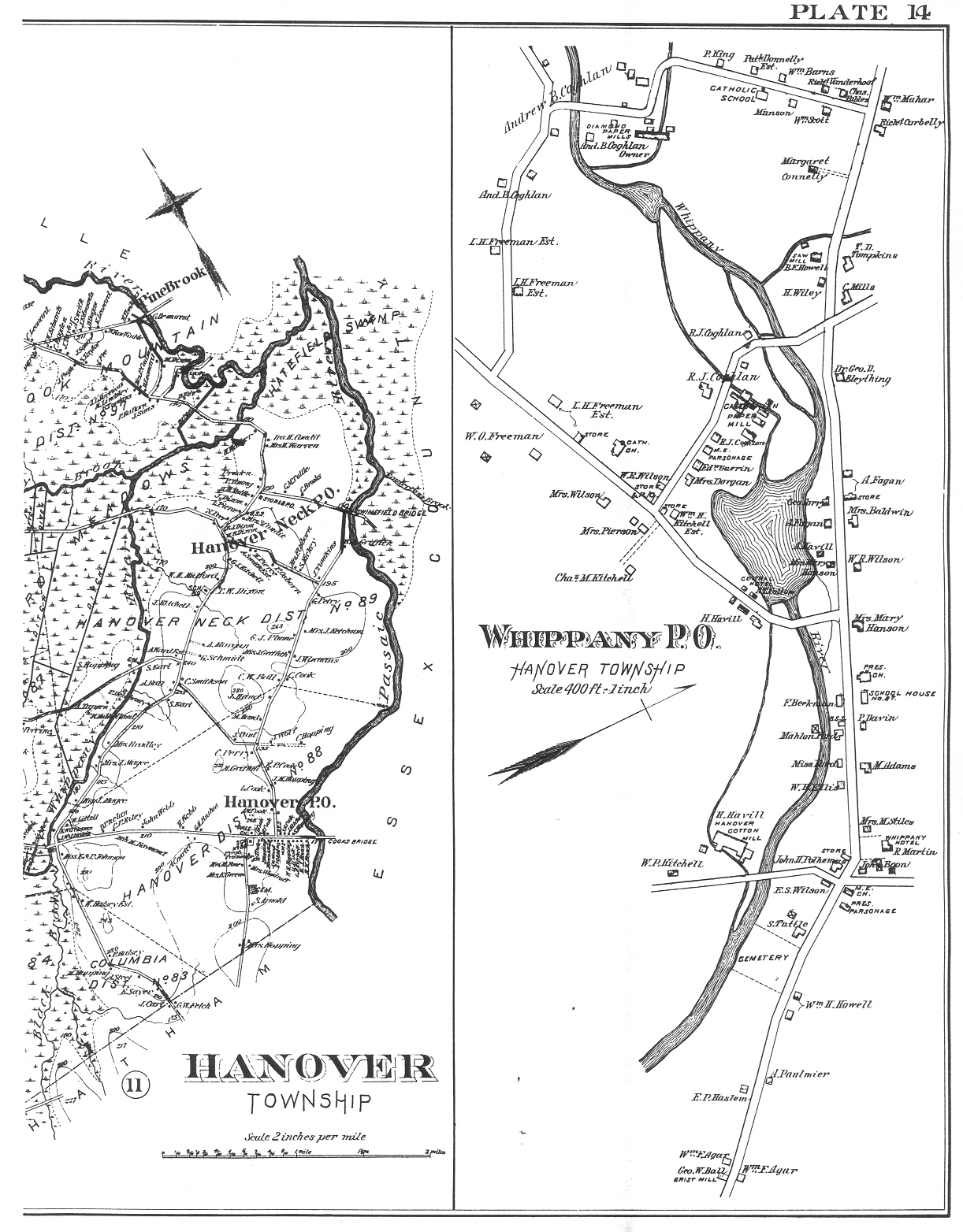
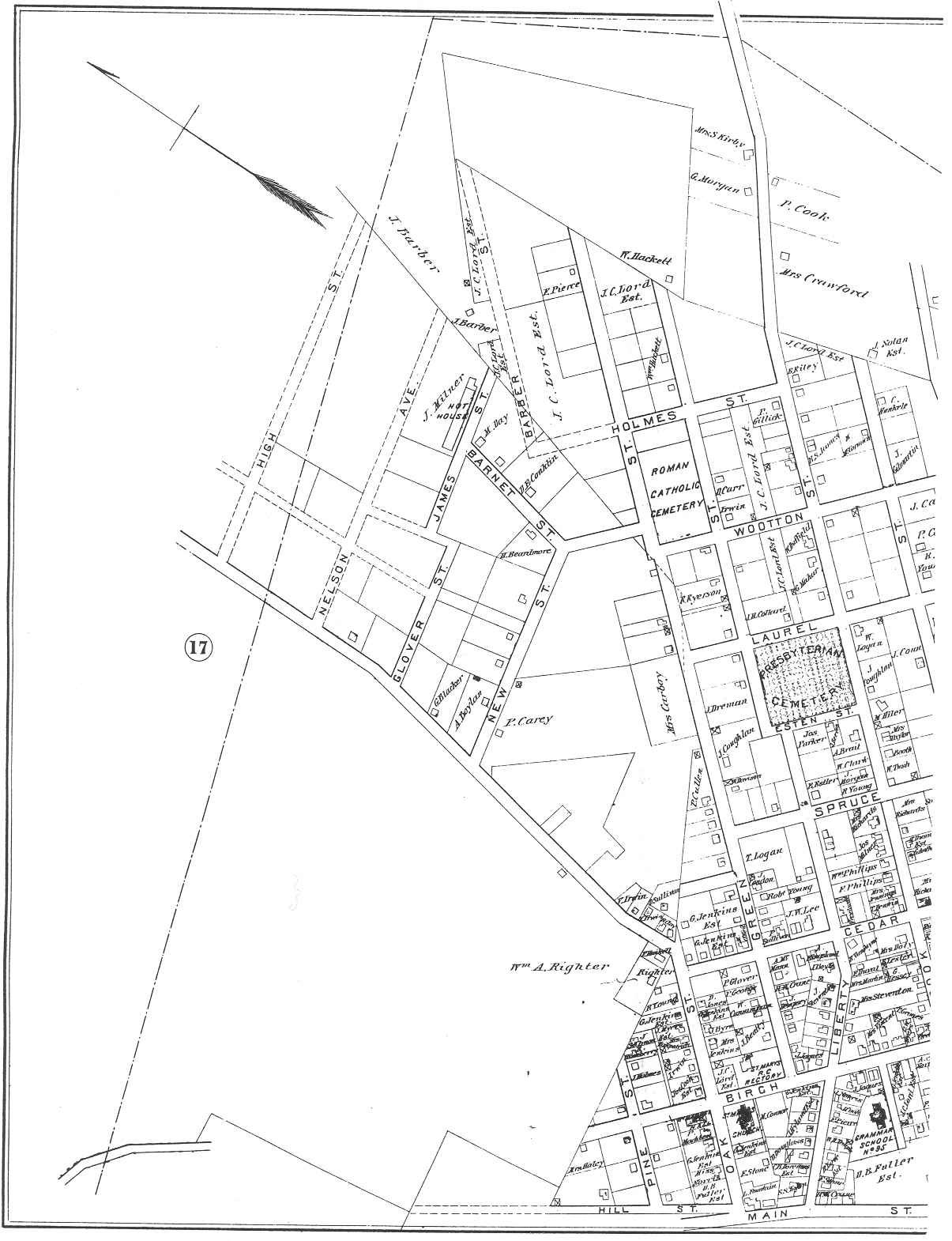
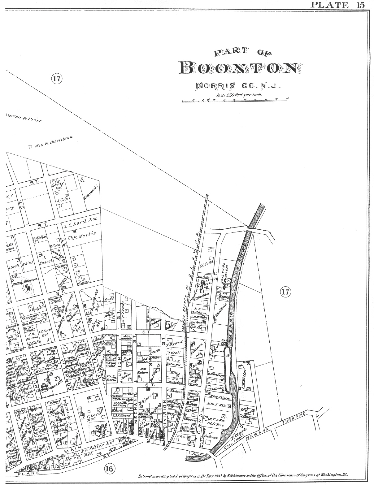
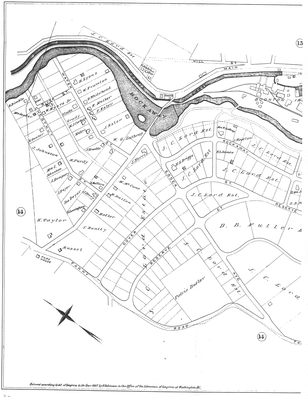
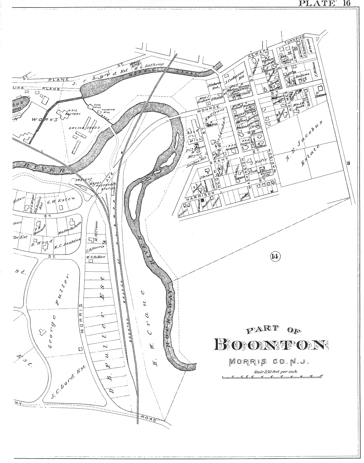
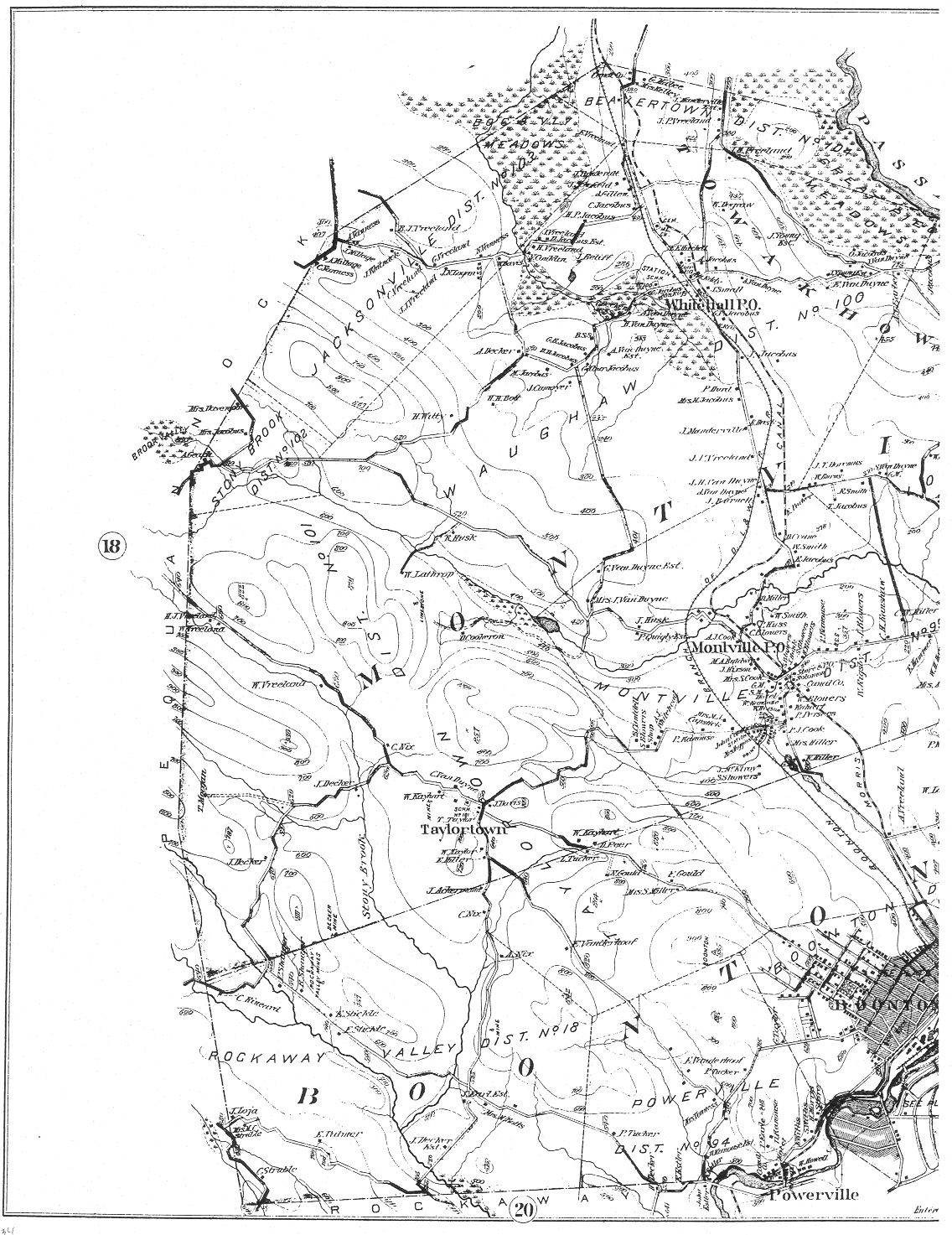
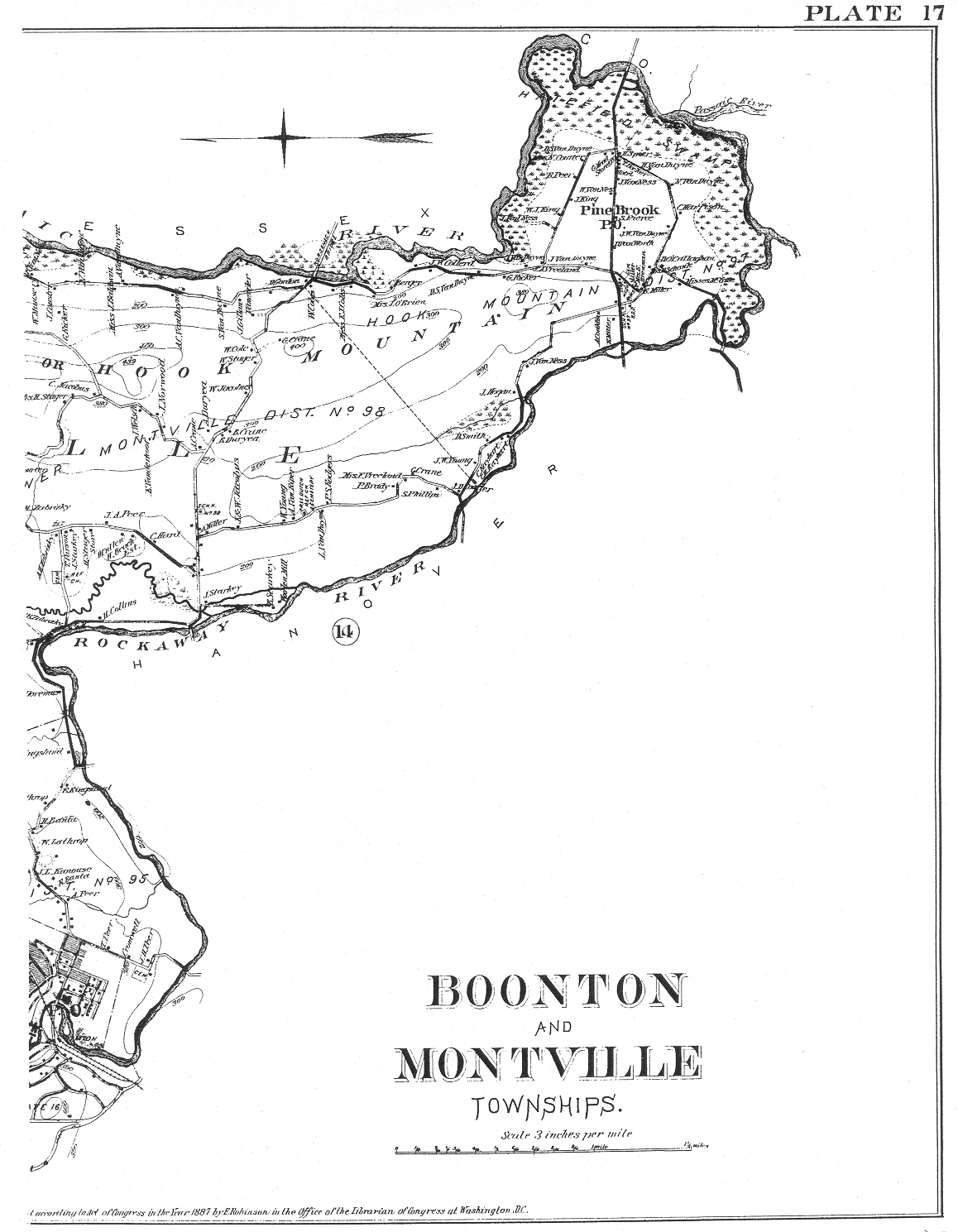
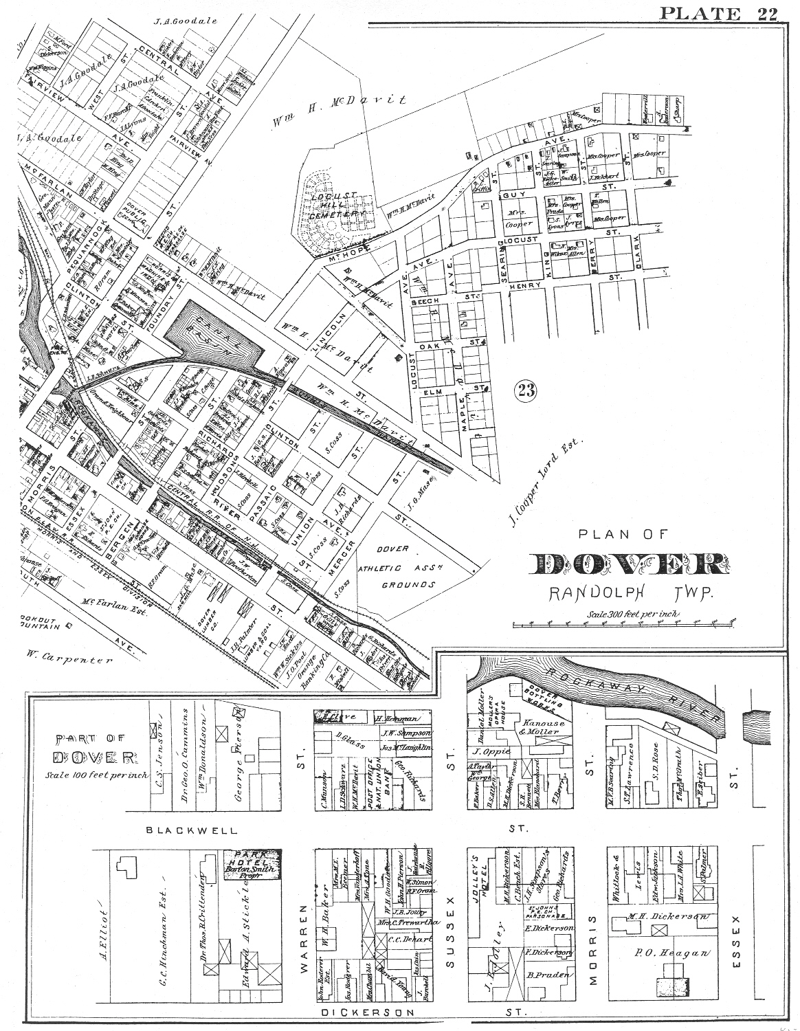
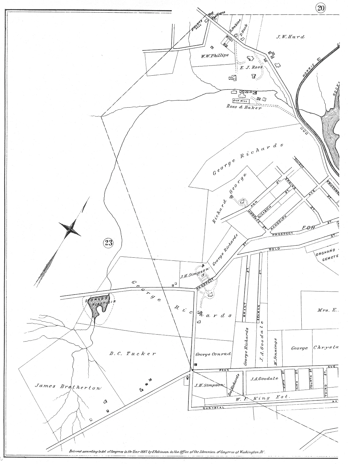
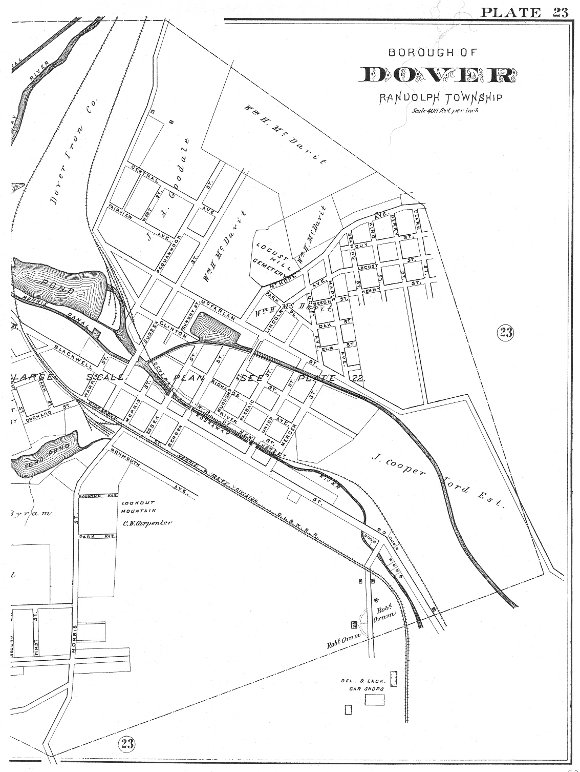
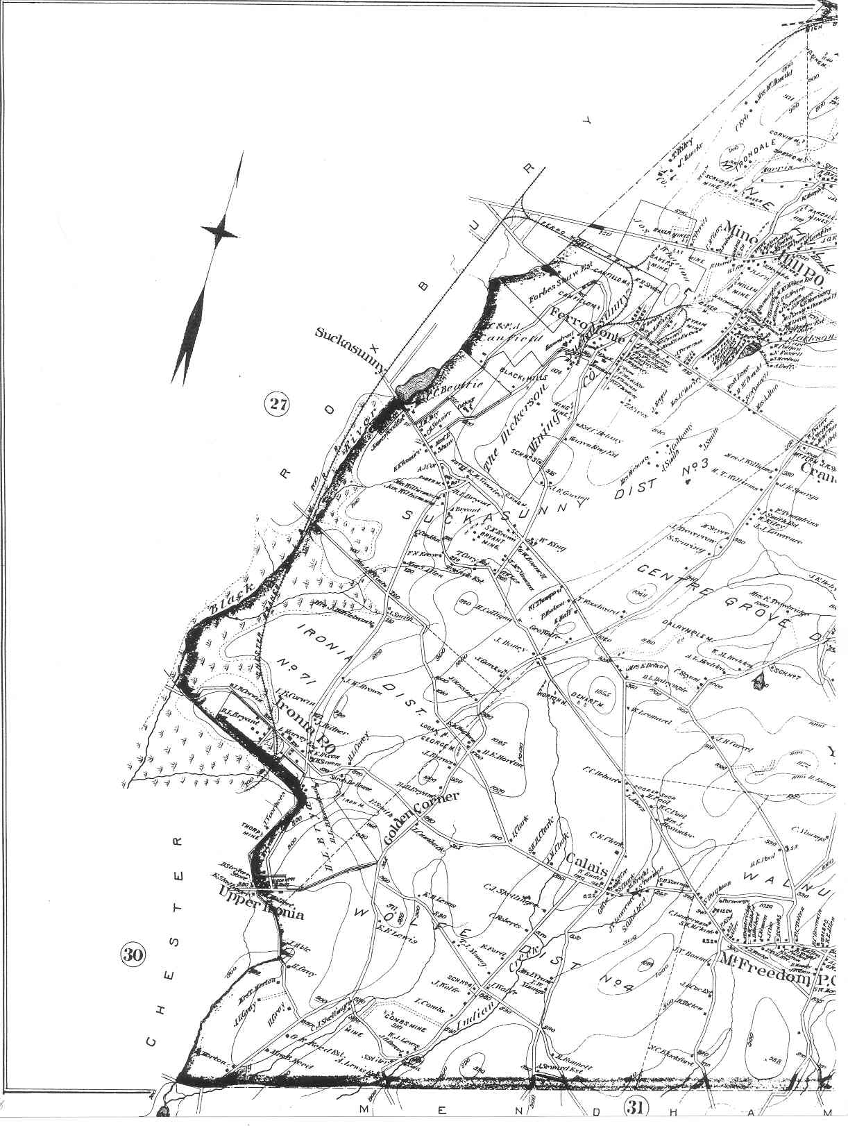
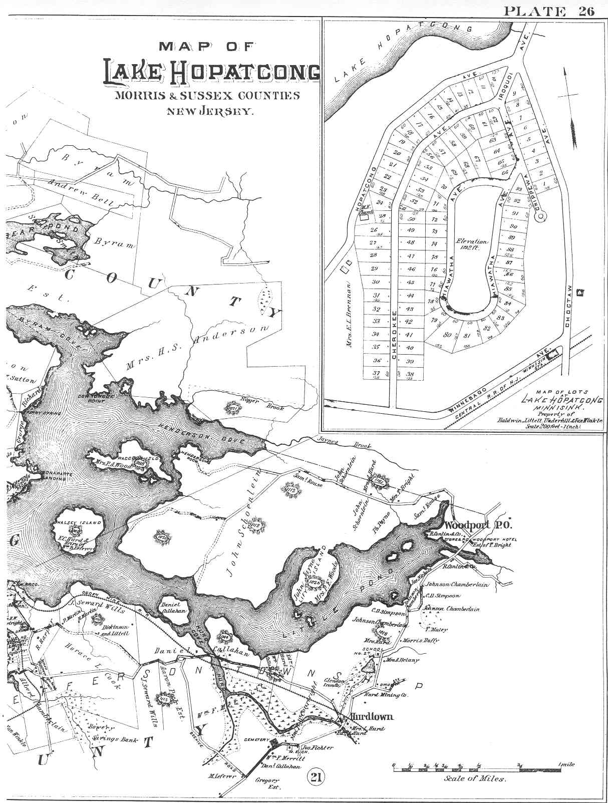
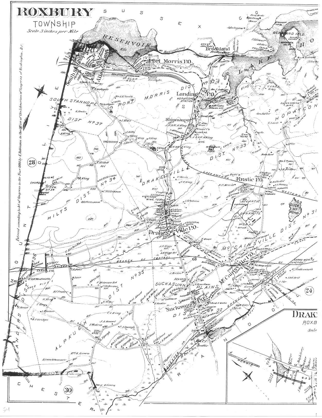
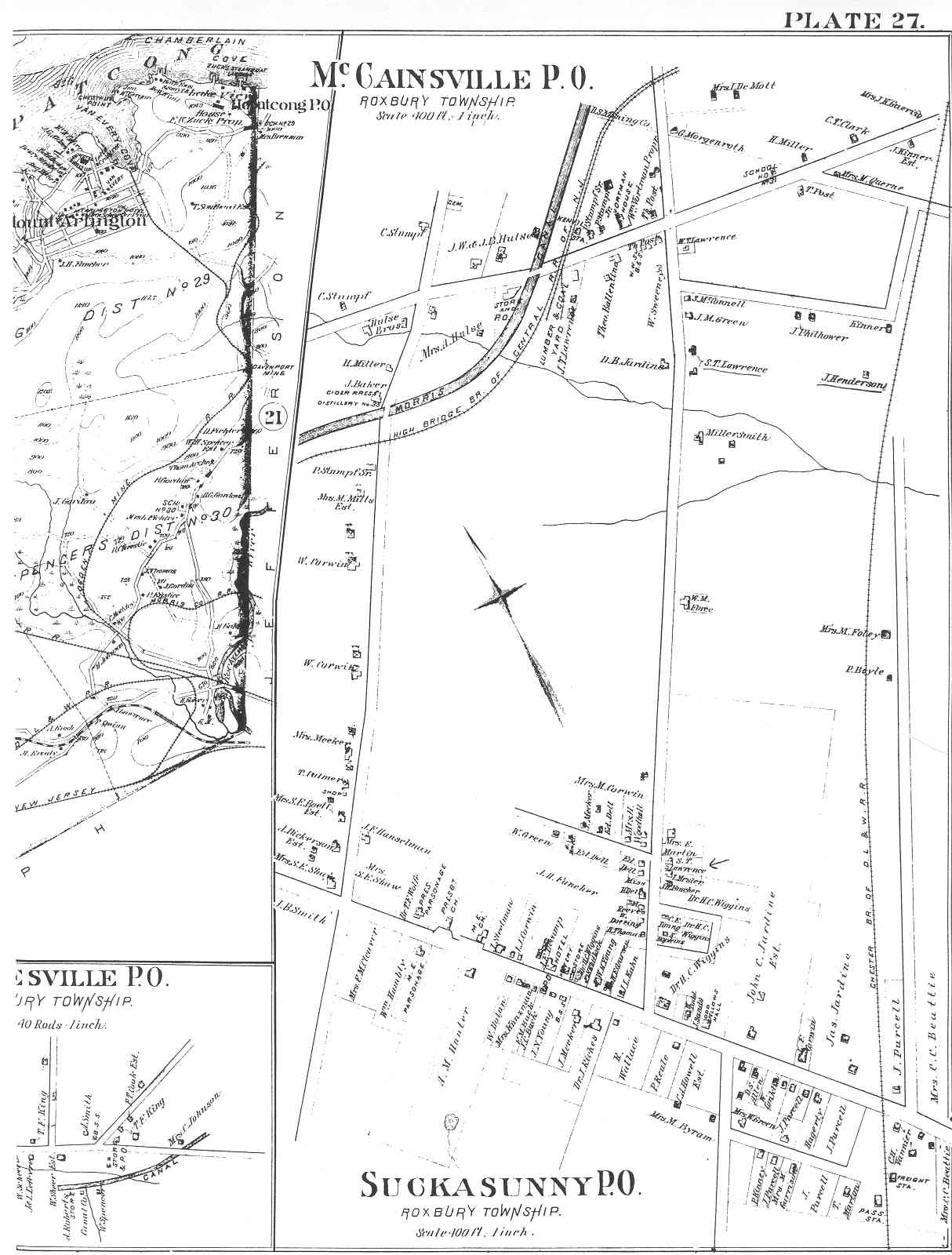
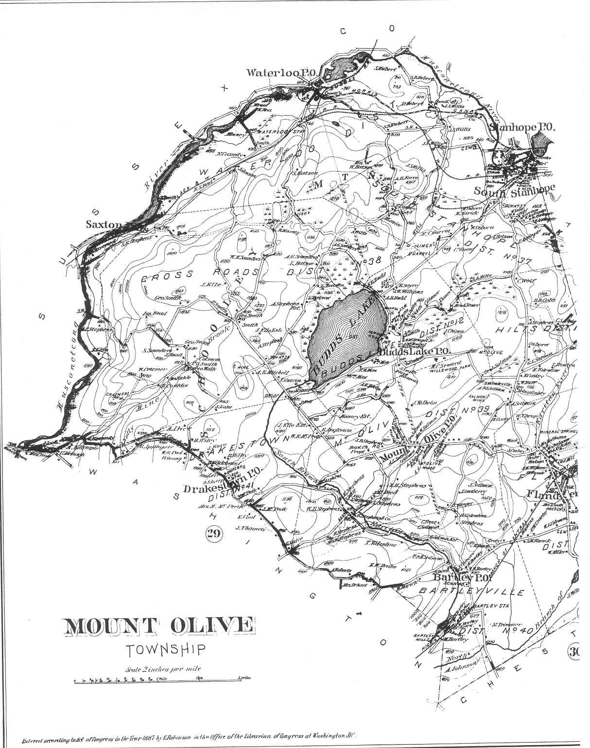
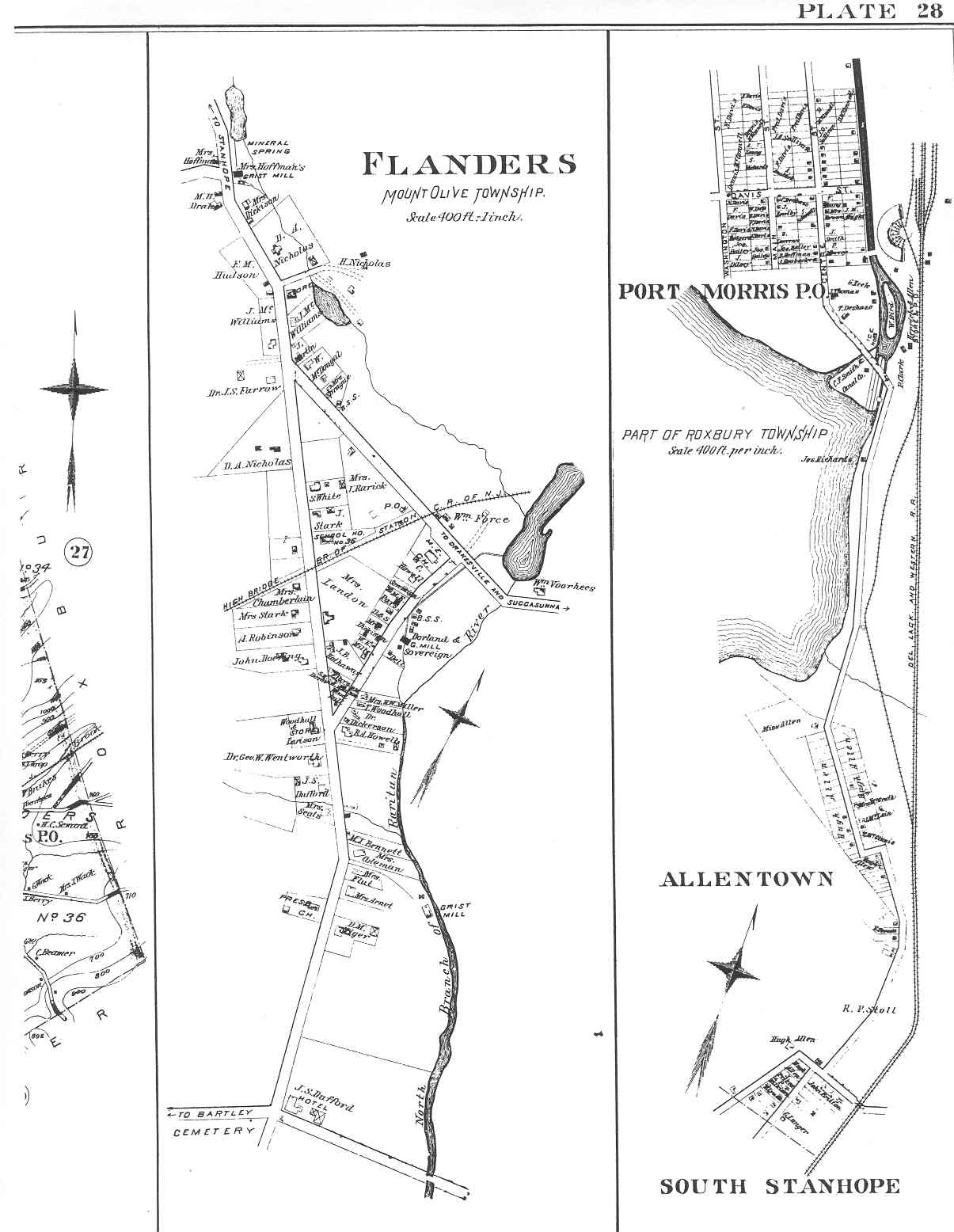
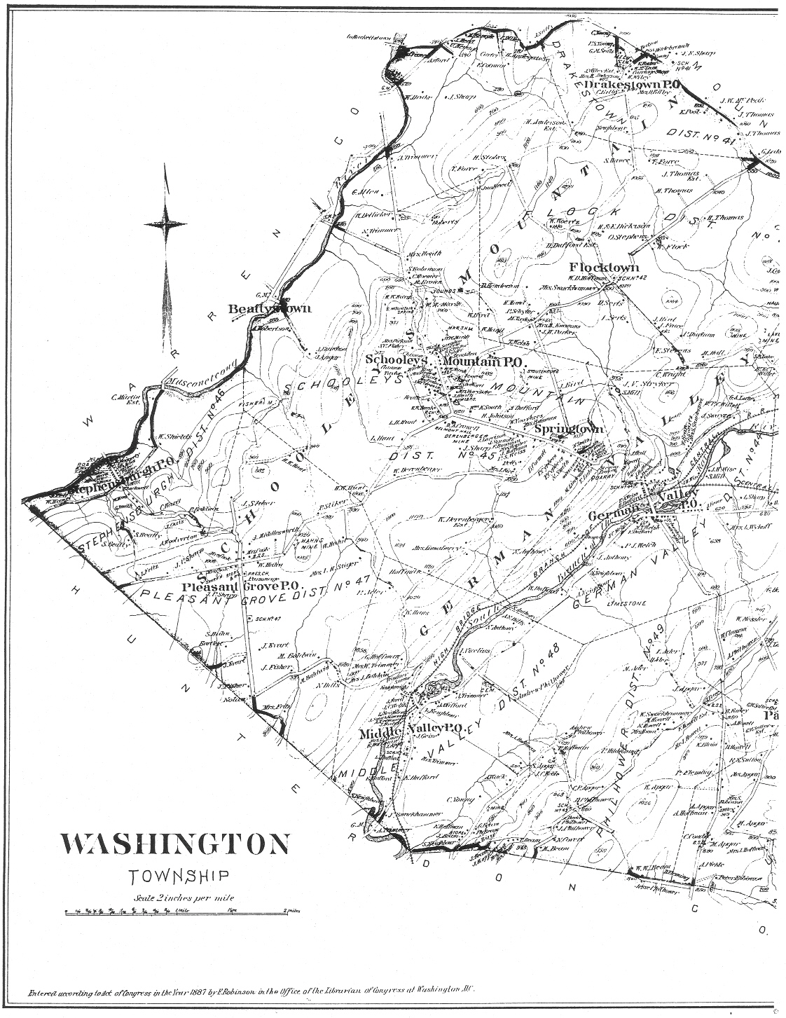
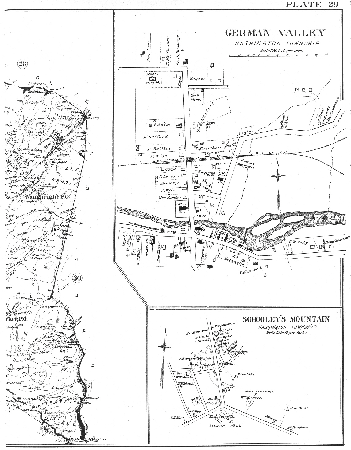
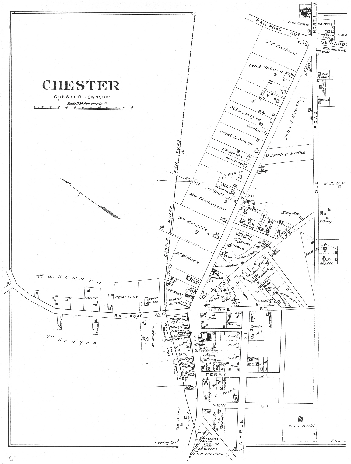
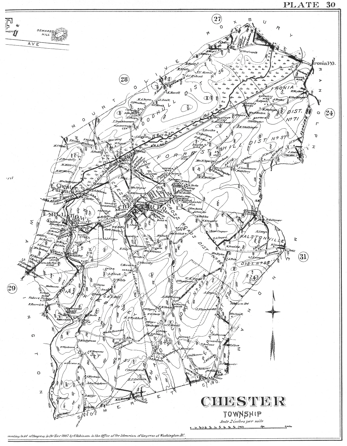
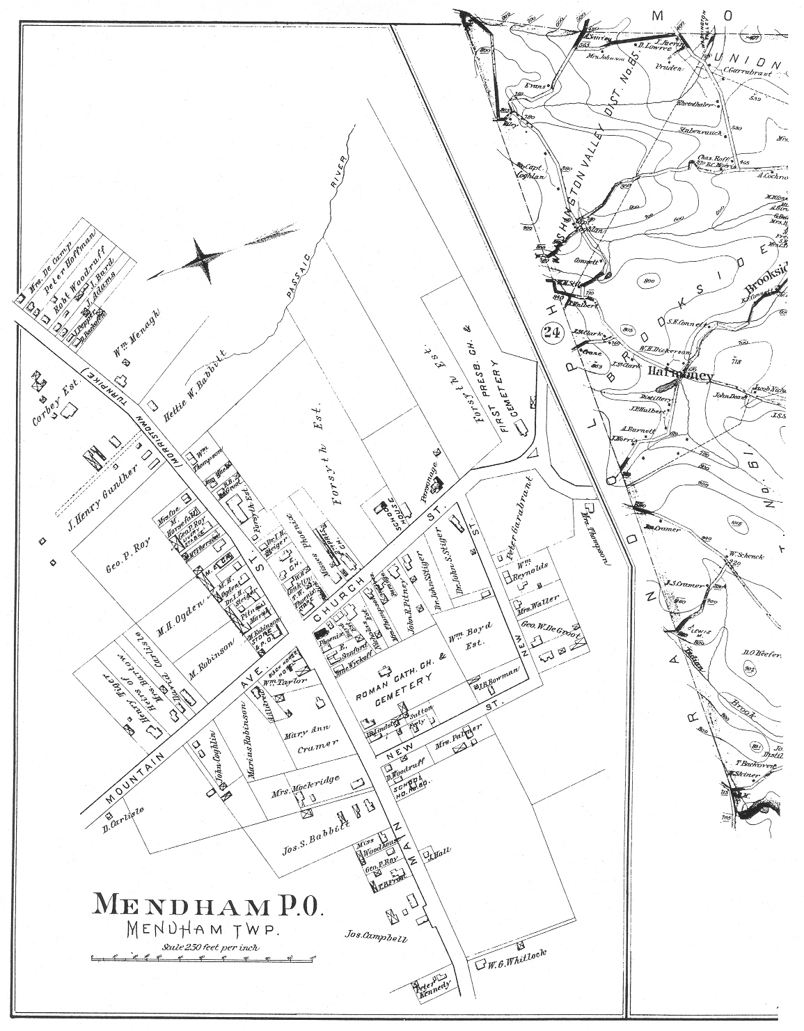
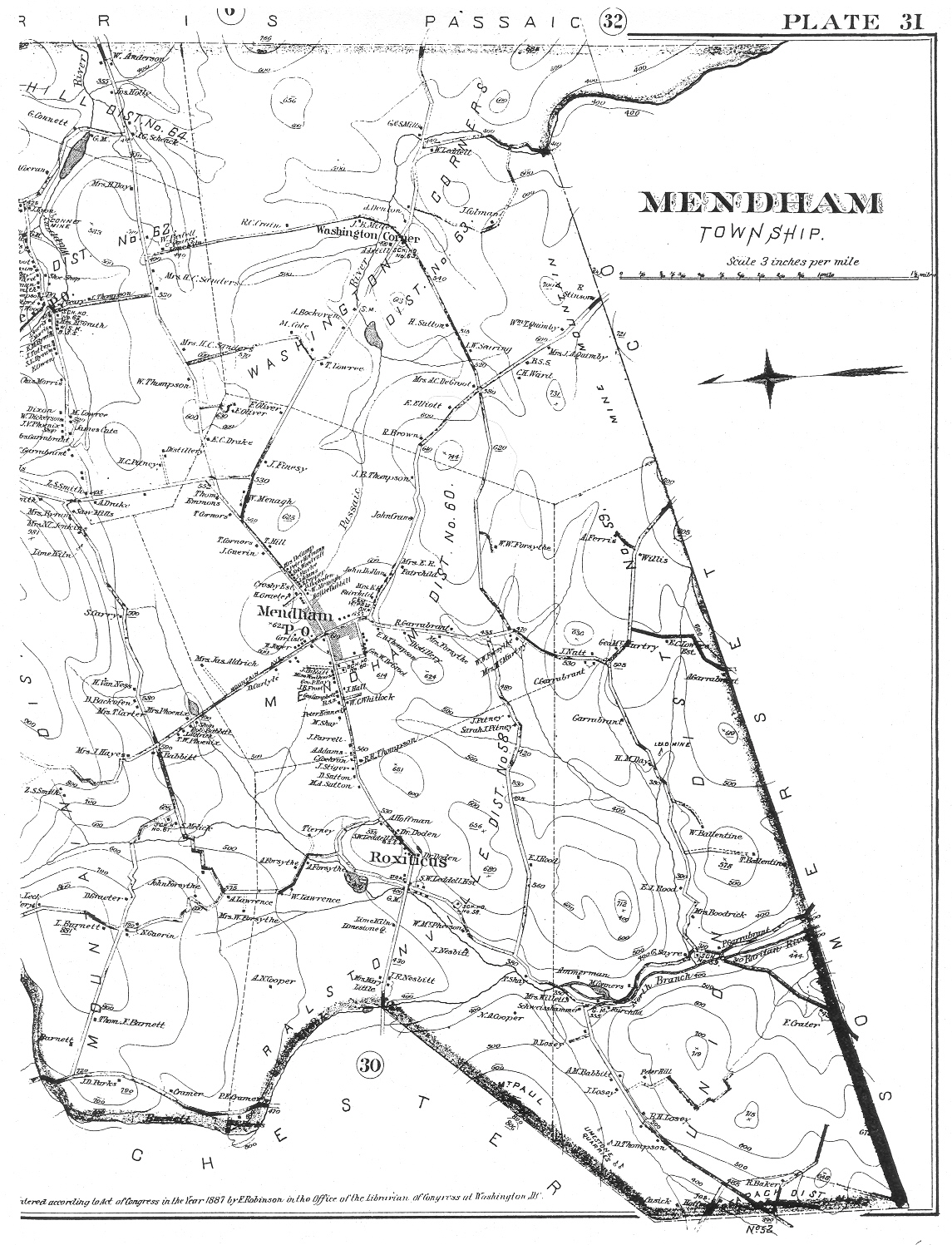
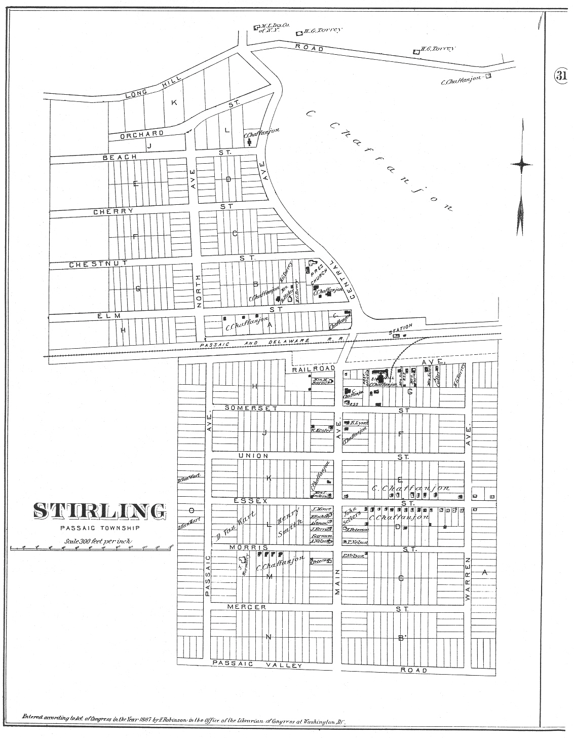
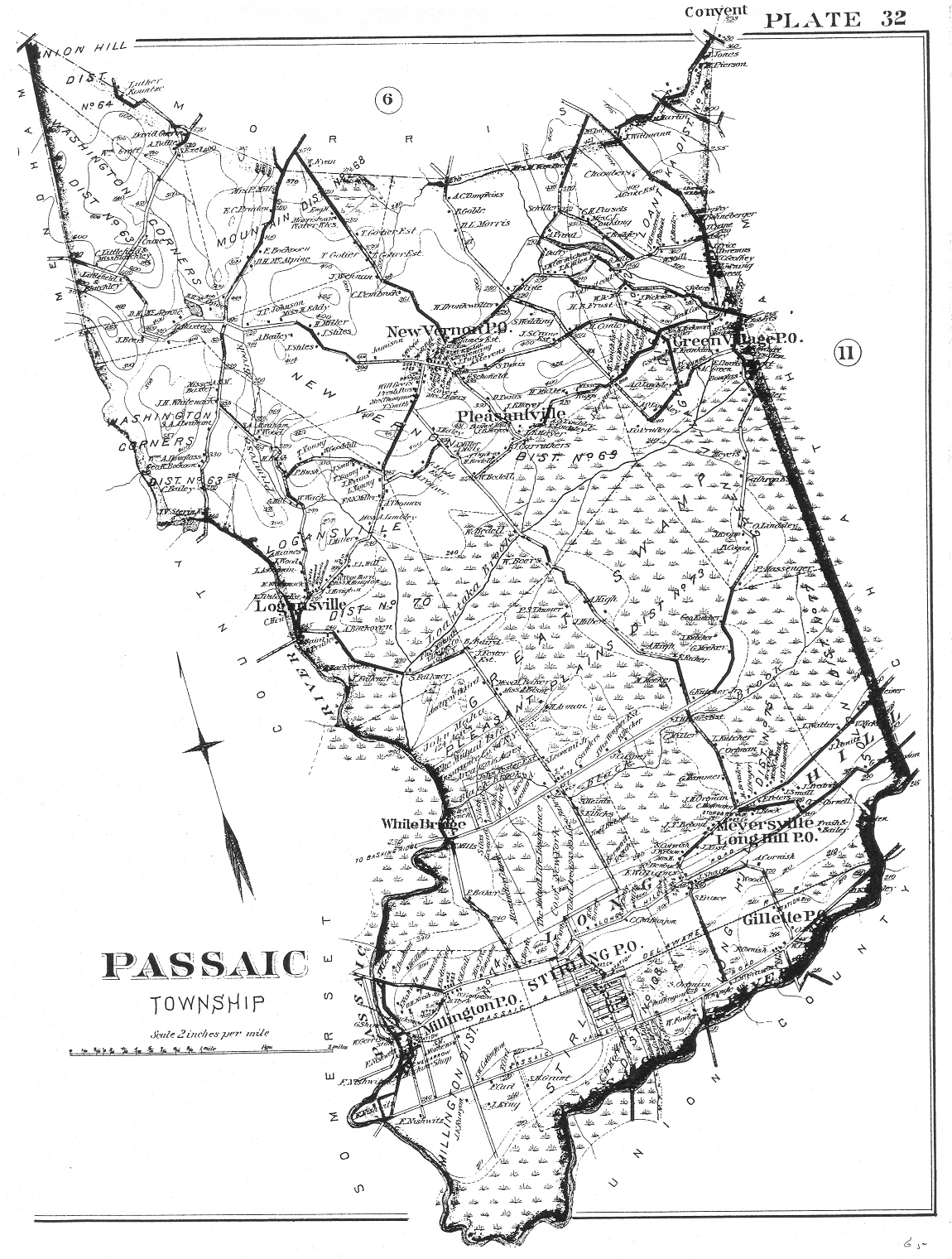
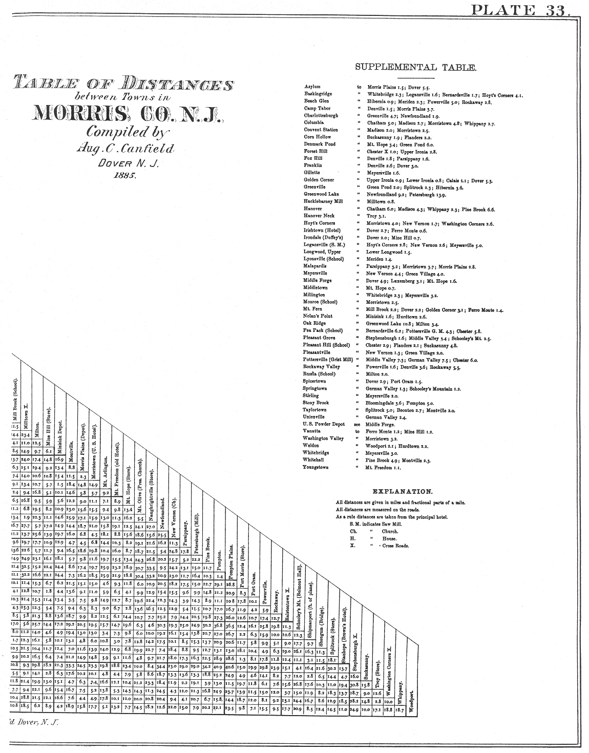
Robinson's Atlas of Morris County New Jersey

E. Robinson, Publisher 1887

This atlas is an 11x17 book. For website purposes I have reduced the size to 8 ½ x 11 then scanned each page in. The original book is divided into Plate maps of, generally, 2 pages each, with a total of 33 Plates.

1887mcpg00.jpg (498979 bytes)

1887mcpg02.jpg (212773 bytes)
Plate 1 - Morris County
1887mcpg03.jpg (295485 bytes)
Plate 1 - Table of Contents

1887mcpg04.jpg (219001 bytes)
Plate 2 (left side)
Part of Morristown

1887mcpg05.jpg (188309 bytes)
Plate 2 (right side)
Part of Morristown
1887mcpg06.jpg (155712 bytes)
Plate 3 (left side)
Part of Morristown
1887mcpg07.jpg (187953 bytes)
Plate 3 (right side)
Part of Morristown

1887mcpg08.jpg (196387 bytes)
Plate 4 (left side)
Part of Morristown

1887mcpg09.jpg (203062 bytes)
Plate 4 (right side)
Part of Morristown
1887mcpg10.jpg (169191 bytes)
Plate 5 (left side)
Part of Morristown
1887mcpg11.jpg (191484 bytes)
Plate 5 (right side)
Part of Morristown

1887mcpg12.jpg (218927 bytes)
Plate 6 (left side)
Morris Township

1887mcpg13.jpg (233884 bytes)
Plate 6 (right side)
Morris Township
1887mcpg14.jpg (132413 bytes)
Plate 7 (left side)
Part of Madison in Chatham, 
Morris and Passaic Townships
1887mcpg15.jpg (124059 bytes)
Plate 7 (right side)
Part of Madison in Chatham, Morris and Passaic Townships

1887mcpg16.jpg (624989 bytes)
Plate 8 (left side)
Part of Madison
Chatham Township

1887mcpg17.jpg (770888 bytes)
Plate 8 (right side)
Part of Madison
Chatham Township

1887mcpg18.jpg (572801 bytes)
Plate 9 (left side)
Part of Madison
Chatham Township

1887mcpg19.jpg (492761 bytes)
Plate 9 (right side)
Part of Madison
Chatham Township

1887mcpg20.jpg (456996 bytes)
Plate 10 (left side)
Plan of Chatham
Chatham Township

1887mcpg21.jpg (799463 bytes)
Plate 10 (right side)
Plan of Chatham
Chatham Township
1887mcpg22.jpg (507096 bytes)
Plate 11 (left side)
Chatham Township
1887mcpg23.jpg (667363 bytes)
Plate 11 (right side)
Chatham Township

1887mcpg24.jpg (597993 bytes)
Plate 12 (left side)
Plan of Morris Plains
Morris & Hanover Townships

1887mcpg25.jpg (460462 bytes)
Plate 12 (right side)
Plan of Morris Plains
Morris & Hanover Townships
1887mcpg26.jpg (510190 bytes)
Plate 13 (left side)
State Asylum for the Insane
Morris Plains, Hanover Twp
1887mcpg27.jpg (497574 bytes)
Plate 13 (right side)
State Asylum for the Insane
Morris Plains, Hanover Twp

1887mcpg28.jpg (905887 bytes)
Plate 14 (left side)
Hanover Township

1887mcpg29.jpg (711980 bytes)
Plate 14 (right side)
Hanover Township

1887mcpg30.jpg (575345 bytes)
Plate 15 (left side)
Part of Boonton
1887mcpg31.jpg (609205 bytes)
Plate 15 (right side)
Part of Boonton

1887mcpg32.jpg (673499 bytes)
Plate 16 (left side)
Part of Boonton

1887mcpg33.jpg (598506 bytes)
Plate 16 (right side)
Part of Boonton
1887mcpg34.jpg (839267 bytes)
Plate 17 (left side)
Boonton & Montville Townships
1887mcpg35.jpg (490522 bytes)
Plate 17 (right side)
Boonton & Montville Townships

wpe44794.gif (268448 bytes)
Plate 18 (left side)
Plan of Butler
Pequannock Twp

wpe05141.gif (274755 bytes)
Plate 18 (right side)
Pequannock Twp
wpe04105.gif (252785 bytes)
Plate 19 (left side)
Rockaway
Rockaway Twp
wpe20256.gif (325752 bytes)
Plate 19 (right side)
Enlarged plan of Rockaway

wpe57455.gif (343086 bytes)
Plate 20 (left side)
Rockaway Twp

wpe36047.gif (293083 bytes)
Plate 20 (right side)
Rockaway Twp
wpe73083.gif (237802 bytes)
Plate 21 (left side)
Jefferson Twp
wpe44266.gif (193759 bytes)
Plate 21 (right side)
Jefferson Twp.

wpe60703.gif (276796 bytes)
Plate 22 (left side)
Plan of Dover
Randolph Twp

1887mcpg45.jpg (868371 bytes)
Plate 22 (right side)
Plan of Dover
Randolph Twp
1887mcpg46.jpg (445905 bytes)
Plate 23 (left side)
Borough of Dover
Randolph Twp
1887mcpg47.jpg (548601 bytes)
Plate 23 (right side)
Borough of Dover
Randolph Twp

1887mcpg48p24a.jpg (206508 bytes)
Plate 24 (left side)
Randolph Twp

1887mcpg49p24b.jpg (190956 bytes)
Plate 24 (right side)
Randolph Twp
1887mcpg50p25a.jpg (224699 bytes)
Plate 25 (left side)
Plan of Mount Arlington
Roxbury Twp
1887mcpg51p25b.jpg (169586 bytes)
Plate 25 (right side)
Plan of Port Oram
Roxbury Twp

1887mcpg52p26a.jpg (235719 bytes)
Plate 26 (left side)
Map of Lake Hopatcong
Morris & Sussex Counties

1887mcpg53p26b.jpg (229338 bytes)
Plate 26 (right side)
Map of Lake Hopatcong
Morris & Sussex Co.

1887mcpg54p27a.jpg (258652 bytes)
Plate 27 (left side)
Roxbury Township
1887mcpg55p27b.jpg (186987 bytes)
Plate 27 (right side)
McCainsville PO
Suckasunny PO
Roxbury Township

1887mcpg56p28a.jpg (228499 bytes)
Plate 28 (left side)
Mount Olive Twp

1887mcpg57p28b.jpg (147214 bytes)
Plate 28 (right side)
Flanders - Mt Olive Twp
Port Morris - Roxbury Twp
1887mcpg58p29a.jpg (777746 bytes)
Plate 29 (left side)
Washington Twp
1887mcpg59p29b.jpg (650476 bytes)
Plate 29 (right side)
German Valley
Schooley's Mountain
Washington Twp

1887mcpg60.jpg (482038 bytes)
Plate 30 (left side)
Chester Township

1887mcpg61.jpg (803021 bytes)
Plate 30 (right side)
Chester Township
1887mcpg62.jpg (629632 bytes)
Plate 31 (left side)
Mendham PO
Mendham Twp
1887mcpg63.jpg (761474 bytes)
Plate 31 (right side)
Mendham Township

1887mcpg64.jpg (526899 bytes)
Plate 32 (left side)
Stirling
Passaic Township

1887mcpg65.jpg (883556 bytes)
Plate 32 (right side)
Passaic Township
1887mcpg66.jpg (1056040 bytes)
Plate 33 (left side)
Table of Distances
1887mcpg67.jpg (630982 bytes)
Plate 33 (right side)
Table of Distances
 

Copyright ©1999-2015 by Brianne Kelly-Bly, all rights reserved.