MAIN MENU
- About Lunenberg
- African Americans
- Burials
- Census
- Churches
- Communities
- Miscellaneous
- Families
- History
- Houses & Landmarks
- Land
- Maps
- Marriages
- Resources
- Schools
- Taxes
- Wills
NEIGHBORS
Old Church Maps
Click on images for enlargement |
|
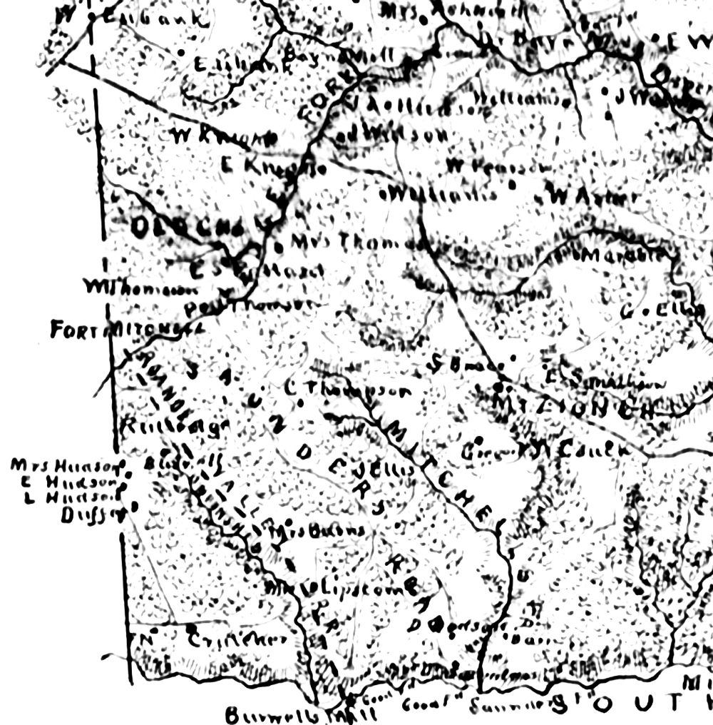
| 1864 Map of Lunenburg Co., Virginia, Section 16 by J. F. Gilmer, Majr. General CSA |
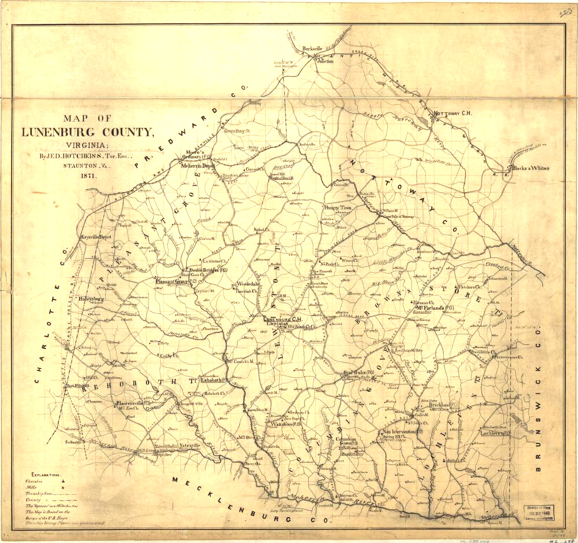 |
Preliminary map of Lunenburg County, Virginia / prepared under the direction of the survey of Washington & Lee University, by Jed. Hotchkiss, Top. Eng., Staunton, VA, 1871. Library of Congress |
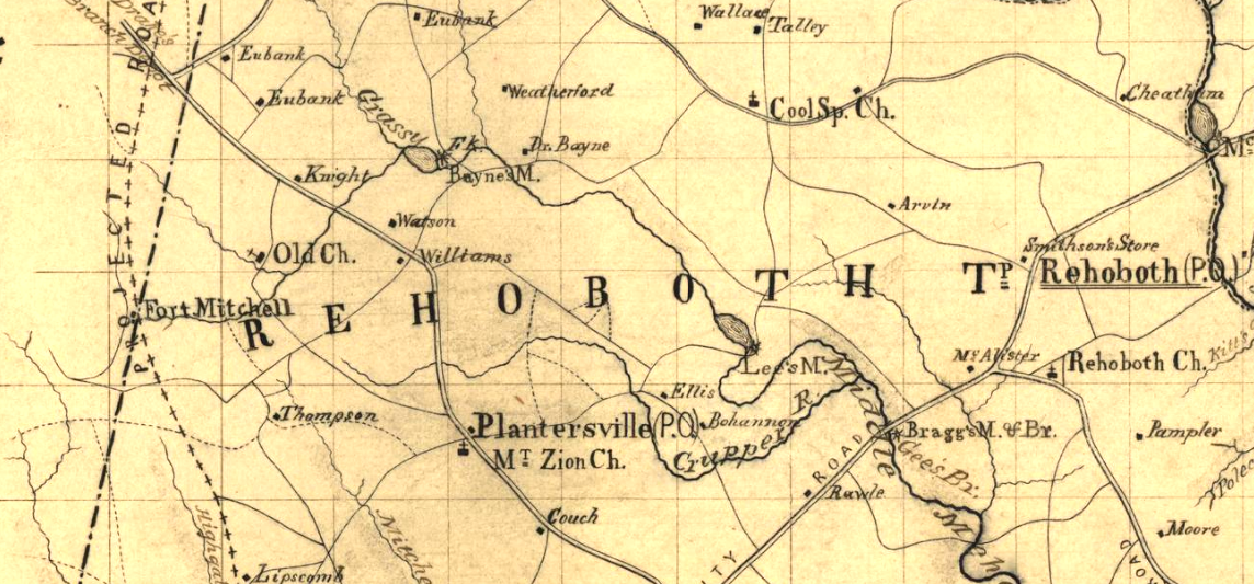 |
Enlarged image from above map showing Fort Mitchell area, Old Church, Mt. Zion Church, Rehoboth Church and Cool Springs Church. |
| Lunenburg DB 16:398 & 424 two deeds in 1793, one from John Hendrick to David Thompson and one from John Hendrick to John Williams show Pledgers Creek and Pledges fork of Maherrin in reference to the "meeting house" and "meeting house path." -Evans. | |